Catalog Archive
Auction 135, Lot 681

"Isle d'Auphine, Communement Nommee par les Europeens Madagascar, et St. Laurens, et Par les Habitans du Pays Madecase…", Sanson/Mariette
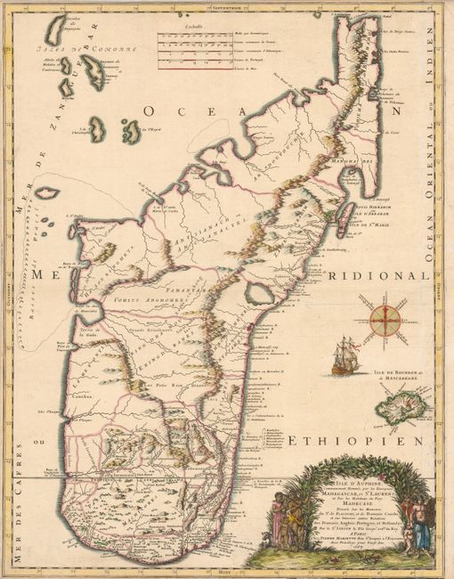
Subject: Madagascar

Period: 1667 (dated)

Publication:

Color: Hand Color

Size:
17.5 x 22.7 inches
44.5 x 57.7 cm
Download High Resolution Image
(or just click on image to launch the Zoom viewer)

This is a splendid, large-scale map of Madagascar and the surrounding islands in the Indian Ocean off the southeast coast of Africa. The map is filled with detail along the coasts and is decorated with an unusual compass rose, sailing ship and a figurative cartouche. The map is based on the report from two early French accounts of the islands; Etienne de Flacourt, a French governor of Madagascar in 1648 and Francois Cauche, who voyaged to Madagascar in 1638.

References:

Condition: B+

Narrow, but adequate, top and bottom margins, as issued. There is a printer's crease and a couple spots in the left border.

Estimate: $550 - $650

Sold for: $500

Closed on 2/16/2011

Archived