Catalog Archive
Auction 135, Lot 67

"America noviter delineata", Merian, Matthaus

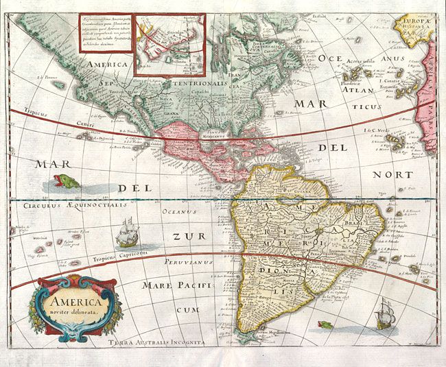
Subject: Western Hemisphere

Period: 1638 (circa)

Publication:

Color: Hand Color

Size:
14.2 x 10.8 inches
36.1 x 27.4 cm
Download High Resolution Image
(or just click on image to launch the Zoom viewer)

Merian prepared this reduced version of his 1631 map for the German translation of Pierre d'Avity's Les Empires du Monde and it accompanied other works of the period including Theatrum Europaeum. It is one of the many derivatives of Jodocus Hondius' map of 1618. North America is depicted with a prominent Virginia and an odd New England coastline. The western coastline above California makes the continent entirely too wide, and there is an odd, dramatic bulge around Mendocino. There is only a hint of the Great Lakes. There is a large inland lake in equatorial South America. Greenland, Iceland and the fictitious Frislandia are shown in a small inset map. Strapwork title cartouche, sea monsters and Spanish galleons decorate the map. Merian's signature is located at the lower right.

References: Burden #251.

Condition: A

Clean and bright with some minor cockling along centerfold.

Estimate: $950 - $1,200

Sold for: $700

Closed on 2/16/2011

Archived