Catalog Archive
Auction 135, Lot 658

"Exacta & Accurata Delineatio cum Orarum Maritimarum tum etiam Locorum Terrestrium quae in Regionibus China, Cauchinchina, Camboja sive Champa, Syao, Malacca, Arracan & Pegu…", Linschoten/Langren

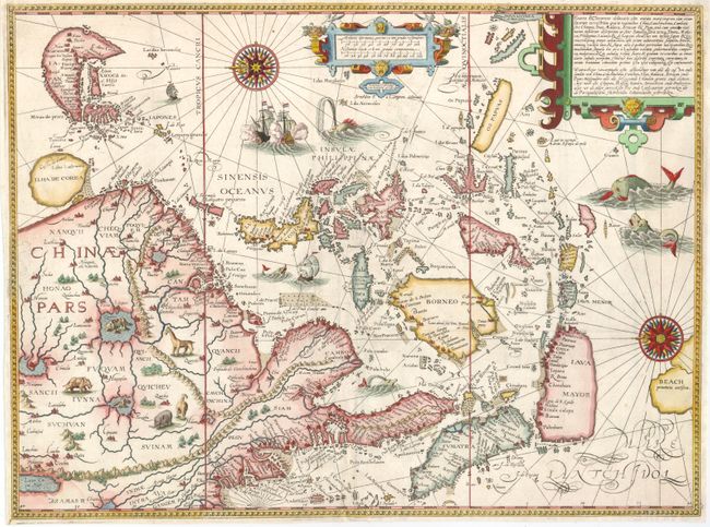
Subject: Southeast Asia

Period: 1595 (dated)

Publication: Itinerario

Color: Hand Color

Size:
20.5 x 15.2 inches
52.1 x 38.6 cm
Download High Resolution Image
(or just click on image to launch the Zoom viewer)

This influential map was the first published map of the Far East to be derived from Portuguese sources. Thus it is credited with breaking the Portuguese monopoly on the East Indian trade and was among the most important sources of information on Southeast Asia during the sixteenth century. The map is oriented with north to the left by two gorgeous compass roses. While based primarily on Portuguese portolan charts, Linschoten also drew on the cartographic work of Plancius. Southeast Asia and Japan are based on the cartography of Fernão Vaz Dourado, and China on the map of Barbuda. The Philippines is drawn from de Lasso with the curious orientation of Palawan. In other regions, Linschoten draws upon the reports of Marco Polo, most notably for the location of the mythical land of Beach provincia auriferain the region where Australia would eventually be discovered. On the mainland, the course of the Mekong is placed too far west, significantly distorting the region and four large lakes in the interior are based on Chinese legend. Corea is shown as a large circular island. The map was beautifully engraved by Langren and is richly adorned with sea monsters and sailing vessels, along with a number of animals in the interior of China. Printed on two sheets, as issued.

References: Schilder #18; Suarez (SEA) fig. 91; Walter #12.

Condition: A

Issued folded, now flattened. Some professionally reinforced folds with remnants of tissue hinges on verso.

Estimate: $8,000 - $9,500

Sold for: $9,000

Closed on 2/16/2011

Archived