Catalog Archive
Auction 135, Lot 623

"Asia ex Magna Orbis Terre Descriptione Gerardi Mercatoris Desumpta, Studio et Industria G.M. Iunioris", Mercator, Gerard (the younger)
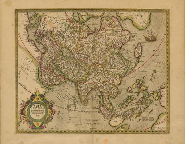
Subject: Asia

Period: 1610 (circa)

Publication:

Color: Hand Color

Size:
18.5 x 15.8 inches
47 x 40.1 cm
Download High Resolution Image
(or just click on image to launch the Zoom viewer)

Derived from the elder Mercator’s world map of 1569, this map of Asia was engraved by his grandson. The coasts of Northeast Asia and Northwest North America are separated by Gastaldi's fabled Strait of Anian. South of this strait a beautifully engraved galleon gives speculation to the possibility of a northern route to Asia. Sumatra has a curiously archaic outline, while the relationship between New Guinea and Terra Australis is left to the viewer's imagination. The place names, Beach, Regio, Lucach and Maletur are all taken from Marco Polo's account, but erroneously ascribed to locations in the vicinity of present-day Australia. French text on verso.

References: Yeo #13.

Condition: C+

Nice impression with original color on a sheet with full margins. Centerfold split at top and bottom just into border with an old paper repair on verso. There are a few short marginal tears and some soil and foxing mostly in margins.

Estimate: $1,400 - $1,600

Unsold

Closed on 2/16/2011

Archived