Catalog Archive
Auction 135, Lot 475

"Typus Frisiae Veteris : inter Rheni medium ostium et Amisiam Itemque, Insulae Batavorum … Disponente Bernhardo Schotano a Sterringa", Halma, Francois

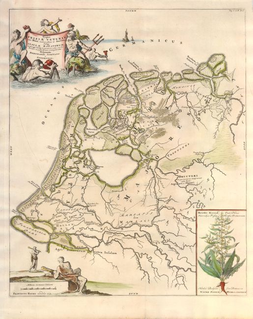
Subject: Netherlands

Period: 1718 (dated)

Publication: Uitbeelding der Heerlijkheit Friesland…

Color: Hand Color

Size:
15.6 x 19 inches
39.6 x 48.3 cm
Download High Resolution Image
(or just click on image to launch the Zoom viewer)

This rare, historical map of Friesland is from Halma's edition of Bernard Schotanus van Sterringa's Atlas of Friesland. In this edition Halma added this historical map by Schotanus, plus seven other historical maps by Menso Alting. The map includes an inset the Briette Kroed (Rumex hydrolapathum) a plant that is native to the fens and river banks throughout the region. The map is embellished with scenes of Neptune and his entourage around the title cartouche and two Wildmen with their clubs on the distance scale cartouche.

References:

Condition: B

Issued folded, now flattened. A long binding tear through half the map has been professional repaired. Paper has been added to the right margin to better accommodate framing.

Estimate: $140 - $180

Sold for: $100

Closed on 2/16/2011

Archived