Catalog Archive
Auction 135, Lot 389

"Carte de la Terre Ferme, du Perou, du Bresil, et du Pays des Amazones…", Delisle/Dezauche

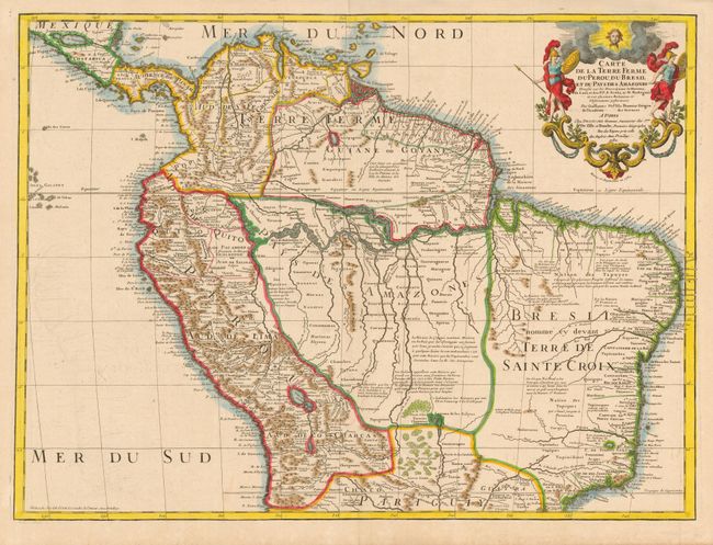
Subject: South America - Northern

Period: 1782 (dated)

Publication:

Color: Hand Color

Size:
25.6 x 19 inches
65 x 48.3 cm
Download High Resolution Image
(or just click on image to launch the Zoom viewer)

This handsome and important map of the northern part of South America is filled with information and notations speculating about the Indian tribes and the tributaries of the Amazon. The capitaineries are shown along the coast of Brazil. A notation in Guyana notes the mythical Lac de Parime on which the golden city of Manoa del Dorado was supposed to be located. The central part of the map (Pays des Amazones) is filled with Indian names. The Inca Way (Grand chemin des Ingas) is shown from Chuquisaca in Peru to Pasto in Colombia. The title cartouche features mythical Amazon warriors, a pot of gold and King Louis XIV, as the Sun King. This is the revised edition, published by Dezauche.

References:

Condition: A

Estimate: $350 - $400

Sold for: $300

Closed on 2/16/2011

Archived