Catalog Archive
Auction 135, Lot 380

"Plan of the Isle of Trinidad, from Actual Surveys made in the Year 1797", Laurie & Whittle
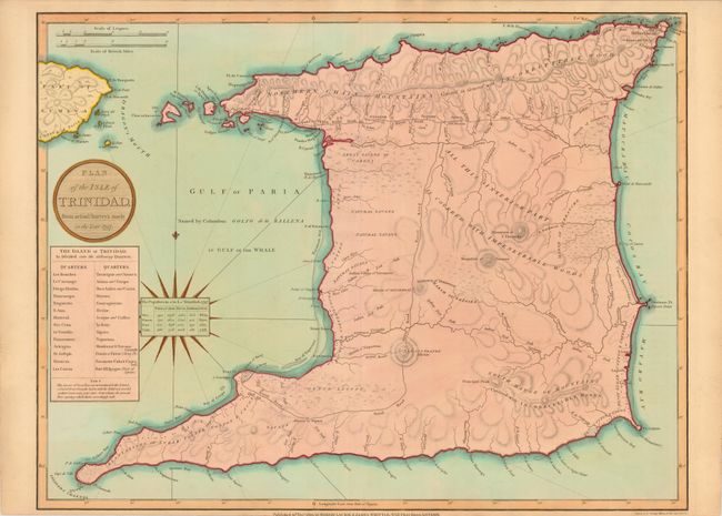
Subject: Trinidad

Period: 1800 (dated)

Publication: A New & Elegant … Atlas

Color: Hand Color

Size:
25.3 x 19.5 inches
64.3 x 49.5 cm
Download High Resolution Image
(or just click on image to launch the Zoom viewer)

A large, scarce plan of the island of Trinidad with a chart at the left showing the 28 quarters that the island was divided into at the time. The Mountain of Tamana is portrayed within the interior, noted as being 'covered with impenetrable woods.' A number of foot paths and roads are noted including the Royal Road and the Indian Road. The information for the map was taken in 1797, the year the British raided this Spanish possession and turned it into a British colony. A small chart centered on the compass lists the population of the island in 1797 including the populations of slaves, whites, and Indians, all subdivided by gender and age. Engraved by George Allen. This is the first state.

References:

Condition: A+

Fine original color.

Estimate: $1,000 - $1,300

Sold for: $1,100

Closed on 2/16/2011

Archived