Catalog Archive
Auction 135, Lot 349

"A Chart of the West-Indies or the Islands of America Together with the Adjacent Coast from Suriname to Cape Cod &c.", Seller and Price

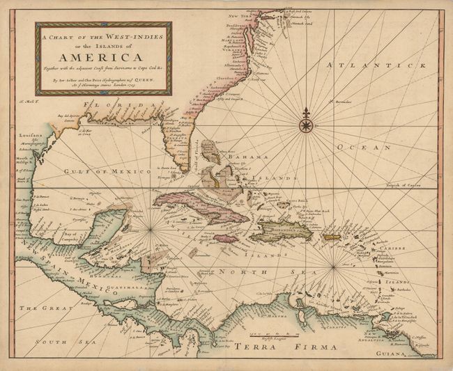
Subject: Gulf of Mexico and Caribbean

Period: 1703 (dated)

Publication:

Color: Hand Color

Size:
23.2 x 18.6 inches
58.9 x 47.2 cm
Download High Resolution Image
(or just click on image to launch the Zoom viewer)

This is an extremely rare English chart of the Gulf of Mexico and Caribbean. It covers the coast of North America from Cape Cod to Suriname in South America, including all of Central America, the Bahamas, Bermuda and the West Indies. Detail is confined to coastal place names with banks and navigational hazards shown in the seas. Engraved by Herman Moll, in his characteristic, forthright style.

The map is a collaborative effort by Jeremiah Seller and Charles Price. Jeremiah, John Seller's son, apprenticed under his father and was a mapmaker, instrument-maker and publisher. He formed a partnership with Price, another young mapmaker, and became "Hydrographers to ye Queen" and "Compass makers to the Navy Royall." In about 1705, complaints over the quality of their instruments caused Seller and Price to lose their contract with the Admiralty and the firm was forced into bankruptcy. Thus their maps are rare in today's market. We can find no sales records for this map for the past 28 years.

References:

Condition: A

Nice impression with some minor tissue repairs on paper edges, not affecting the map.

Estimate: $1,300 - $1,600

Sold for: $1,200

Closed on 2/16/2011

Archived