Catalog Archive
Auction 135, Lot 308

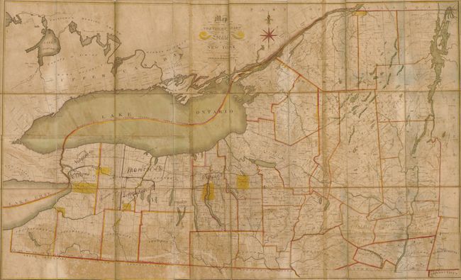
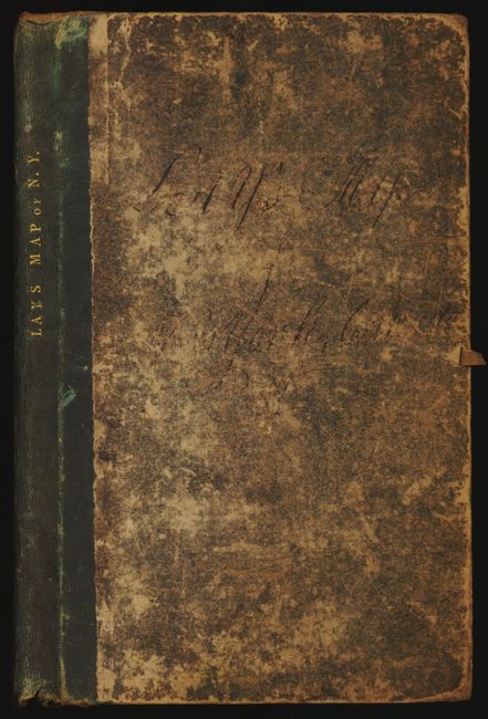
"Map of the Northern Part of the State of New York Compiled from Actual Survey", Lay, Amos

Subject: New York

Period: 1812 (dated)

Publication:

Color: Hand Color

Size:
48.5 x 29.8 inches
123.2 x 75.7 cm
Download High Resolution Image
(or just click on image to launch the Zoom viewer)

This is Lay's rare, separately published case map, segmented and backed with linen and folding into original card covers. Lay published his map in at least three editions: 1801, 1812 and 1817, each progressively extending south to show more of the state. This is the second edition of 1812 which extends to the border with Pennsylvania. In 1817 the larger 3rd edition will extend south to include New York City. Philips and Ristow say the map was engraved by Peter Maverick, but Jo Margaret Mano says it was "probably engraved by him." See her work the Annotated Bibliography of Selected New York State Maps: 1793-1900, a research paper supported by the New York State Library Research Residency Award program. Philips and Ristow further mention Newark, New Jersey as the place of publication, although there is nothing on the map to indicate this. Imprint below title and distance scale "Entered ... 16th day of July 1812 by Amos Lay of the State of New-York." Arthur J. Stansbury is know to have collaborated with Lay on at least the first edition but he is not mentioned on the map.

The map provides a detailed view of the Canadian border just one month after the United States declared war on Great Britain in the War of 1812. The map shows most of Lake Erie and all of Lake Ontario with the counties of Upper Canada well shown. It delineates the St. Laurence River to St. Regis at the US/Canada boundary. Details the route of the Erie Canal, here as a "Proposed Canal" shown running from Lake Erie east to the city of Rome. Filled with information on land surveys and development, wagon roads and trails, Military tracts, towns and villages, and notes Indian Reservations highlighted in yellow.

The map is dissected into forty sections and mounted on linen, as issued. The segments fold into original marbled card covers (6.4 x 10.5") with "Lay's Map of N.Y." stamped in gilt on leather spine. The original case is missing. An early owner has added new county names and borders in black ink, including Niagara, Monroe, Erie, Genesee and Livingston with the date of creation noted.

References: Ristow p. 99 & 103.

Condition: B

A nice example. Overall scattered toning, but the paper has no other flaws. Original linen is likewise sound. Card covers are worn but physically sound.

Estimate: $1,400 - $1,800

Sold for: $1,800

Closed on 2/16/2011

Archived