Catalog Archive
Auction 135, Lot 303

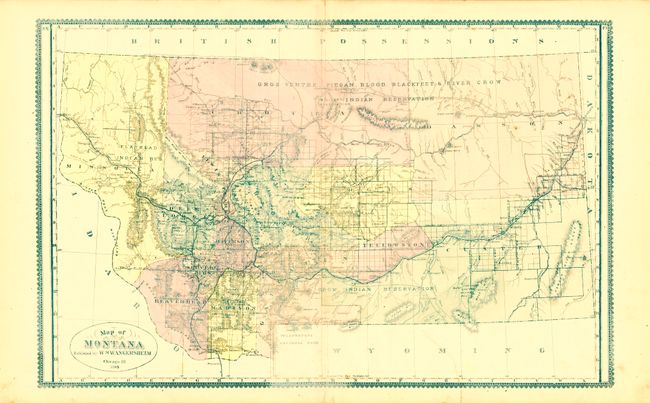
"Map of Montana", Wangersheim, William
Subject: Montana

Period: 1889 (dated)

Publication:

Color: Hand Color

Size:
25.5 x 16.3 inches
64.8 x 41.4 cm
Download High Resolution Image
(or just click on image to launch the Zoom viewer)

This rare map of Montana is printed in blue ink and appears identical to the Montana issue by H.R. Page. This large map shows in great detail the territory as it existed just before attaining statehood on November 8, 1889. Topography is well developed and shown via hachure, while the watershed is equally detailed. Surveyed and settled areas are limited to the southwestern portion. The north and east are composed of the very large counties of Missoula, Chotea, Dawson, and Custer. It locates the large Indian reservations (Blackfeet, Crow, Gros Ventre, Piegan, Blood, Flathead etc.), military posts (Forts - Assiniboine, Keogh, Maginnis, Custer, Camp Baker, etc.) and the completed and proposed railroads. Shows Fort Custer but does not mention Custer Hill, Custer's Monument, or the Reno battlefield. Yellowstone National Park is named but carries no detail. Locates Butte City, Billings, Miles City, Dillon, Virginia City, Deer Lodge City, and many other towns and smaller settlements. Mining areas are noted including Silver Star and Hecla. Surrounded by a banknote-style decorative border.

References:

Condition: B+

At bottom is a closed 3" tear into the uncolored area of Wyoming.

Estimate: $150 - $200

Sold for: $130

Closed on 2/16/2011

Archived