Catalog Archive
Auction 135, Lot 273

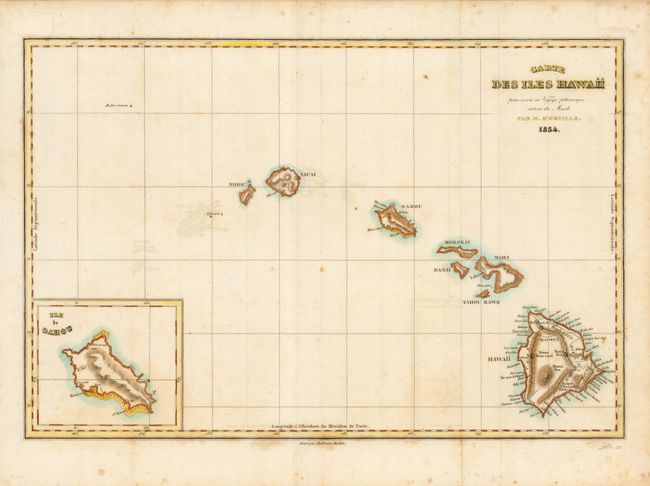
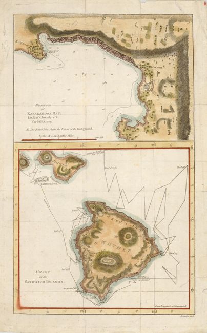
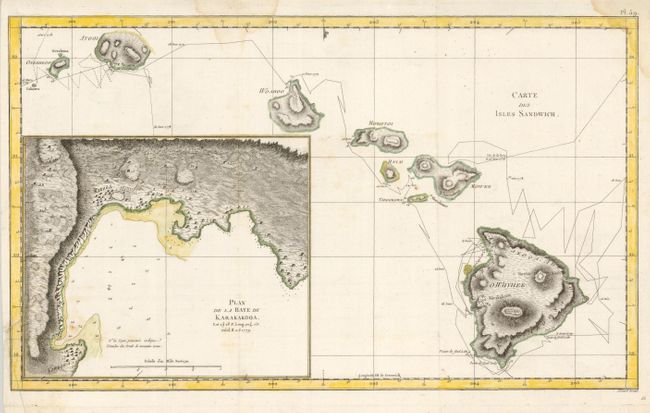
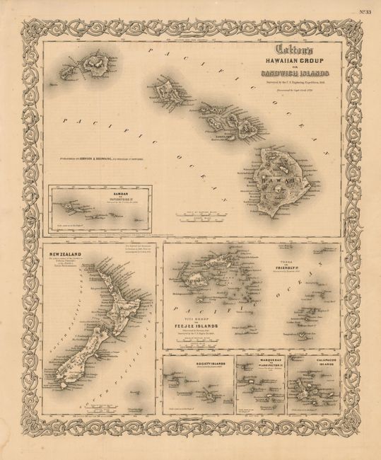
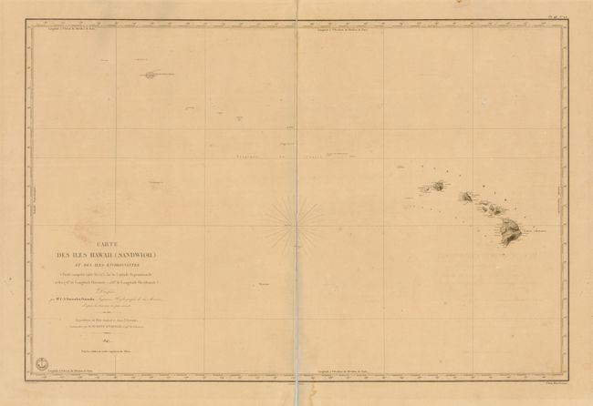
"[Lot of 6 - Hawaii]",

Subject: Hawaii

Period: 1785-1855 (published)

Publication:

Color:

Size:
See Description
Download High Resolution Image
(or just click on image to launch the Zoom viewer)

1, 2 & 3 ) 3 each of Carte des Iles Hawaii, by Jules Sebastian Cesar Dumont d'Urville, 1834, hand color, (13 x 8.5"). A fine chart of the Hawaiian islands with an inset of the Ile de Oahou. Dumont d'Urville circumnavigated the globe for the second time between 1826 and 1829. On this expedition his accomplishments included significant Pacific discoveries. His logs were so detailed that for the first time the scattered islands of the South Pacific could be divided into three major groups: Melanesia, Polynesia and Micronesia. Although the expedition did not pass through Hawaii, this map is very interesting as it is a very early (and perhaps the first) use of the native name Hawaii for the entire island chain. Engraved by Tardieu. The first example is (A), the other two are (B+), one is a clean example but with a centerfold split and mounted on a full sheet for support.

4) Chart of the Sandwich Islands. / Sketch of Karakakooa Bay., by Lodge, circa 1785, hand color, (7.4 x 12.2"). Two charts on one sheet detail the island of Hawaii and Karakakooa Bay. Notation gives the location where Cook was killed. Issued folding with a couple short splits and paper repairs on verso. (B+)

5) Carte des Isles Sandwich. / Plan de la Baye de Karakakooa., by Benard, circa 1785, hand color, (18.2 x 10.8"). This chart shows all of the Sandwich Islands. The large and detailed inset of Karakakooa shows the village, soundings and anchorages in the bay, farmers fields, and some topography. The point of land where Cook was killed shows the small village of Kowrowa. (B+)

6) Colton's Hawaiian Group or Sandwich Islands/Samoan or Navigators Is./New Zealand/Viti Group or Feejee Islands/Society Islands/Marquesas or Washington Is./Galapagos Islands, circa 1855, black & white, (12.8 x 15.6"). A decorative map with several maps of Pacific Islands enclosed in a decorative strapwork border. The upper half is a fine map of the Hawaiian Islands. The six panels below show the Samoan or Navigator Is., New Zealand, Feejee Islands, Society Islands, Marquesas or Washington Is., and Galapagos Islands. Excellent detail and finely engraved. The charts on the sheet were compiled from the surveys of the U.S. Exploring Expedition in 1841. Uncolored, as issued. A little chipping along right edge. (B+)

References:

Condition:

See individual descriptions.

Estimate: $500 - $800

Sold for: $950

Closed on 2/16/2011

Archived