Catalog Archive
Auction 135, Lot 182

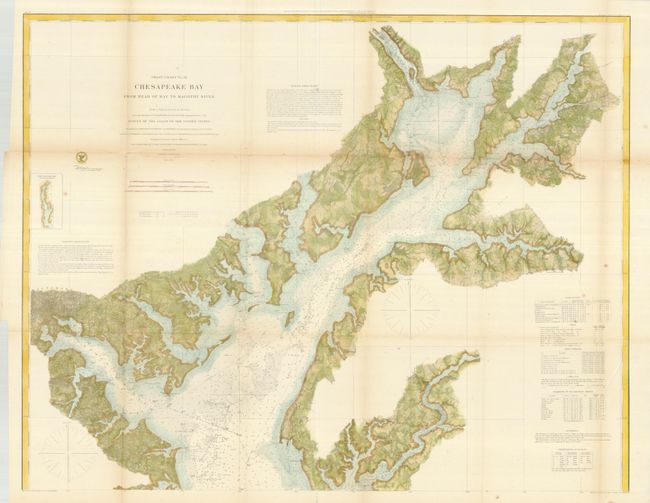
"Coast Chart No. 31- Chesapeake Bay From Head of Bay to Magothy River", U.S. Coast Survey

Subject: Mid-Atlantic

Period: 1861 (dated)

Publication:

Color: Hand Color

Size:
37.5 x 29.5 inches
95.3 x 74.9 cm
Download High Resolution Image
(or just click on image to launch the Zoom viewer)

The Office of Coast Survey is the oldest U.S. scientific organization, dating from 1807 when Congress directed that a "survey of the coast" be carried out. By 1836, it was called the U.S. Coast Survey and in 1878, the name was changed to the U.S. Coast and Geodetic Survey. Today the Office of Coast Survey is a division of the National Oceanic and Atmospheric Administration NOAA.

The survey teams, composed of civilians as well as Army and Naval officers, charted the nation's waterways and produced a wide array of reports, survey charts, hydrographic studies of tides and currents, astronomical studies and observations, and coastal pilots. These charts are an important record of the changing nature of the nation's coastlines. In additional to coastal charts, the U.S. Coast and Geodetic Survey produced land sketches, Civil War battle maps, and the early aeronautical charts.

This a very detailed chart showing the northern reaches of the Chesapeake Bay, from Baltimore to the Susquehanna, Northeast, and Elk rivers. In addition to the expected navigational information and coastal detail, there is considerable interior information given, with indications of fields, woods, roads, and communities. Also shown are lighthouse locations, tidal currents, compass variations, bottom composition, extensive soundings and sailing directions.

References:

Condition: B+

Minimal fold toning with a few fold separations, some closed with archival tape on verso.

Estimate: $200 - $300

Sold for: $150

Closed on 2/16/2011

Archived