Catalog Archive
Auction 135, Lot 131

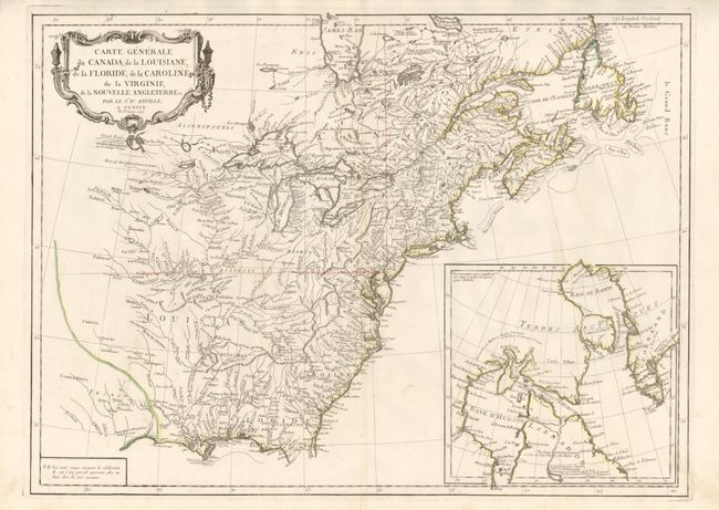
"Carte Generale du Canada, de la Louisiane, de la Floride, de la Caroline, de la Virginie, de la Nouvelle Angleterre etc. par le Sr. d'Anville", D'Anville/Santini

Subject: Colonial United States and Canada

Period: 1776 (dated)

Publication: Atlas Universel

Color: Hand Color

Size:
25.8 x 18.8 inches
65.5 x 47.8 cm
Download High Resolution Image
(or just click on image to launch the Zoom viewer)

This striking map is an Italian edition of d'Anville's map, published in the first year of the American Revolution. The map is filled with detail of rivers and topography, with particular focus on the Great Lakes. Lake Superior is shown attached to a convoluted river system reaching across the continent, reminiscent of the Riviere Longue of Baron Lahontan's memoirs. On the Gulf Coast the region of Tecas (Texas) is named with a nearby note about the Atac-apa tribe of Indians, who are noted as Antrophages (Cannibals) and Indiens errans (Wild Indians). The inset at lower right is a detailed map of Hudson and Baffin Bays illustrating Christopher Middleton's discoveries in 1742 in his search for the fabled Northwest Passage.

References: McCorkle #776.3; Sellers & Van Ee #136.

Condition: A

The original outline color is slightly faded, else fine.

Estimate: $600 - $800

Sold for: $400

Closed on 2/16/2011

Archived