Catalog Archive
Auction 135, Lot 126

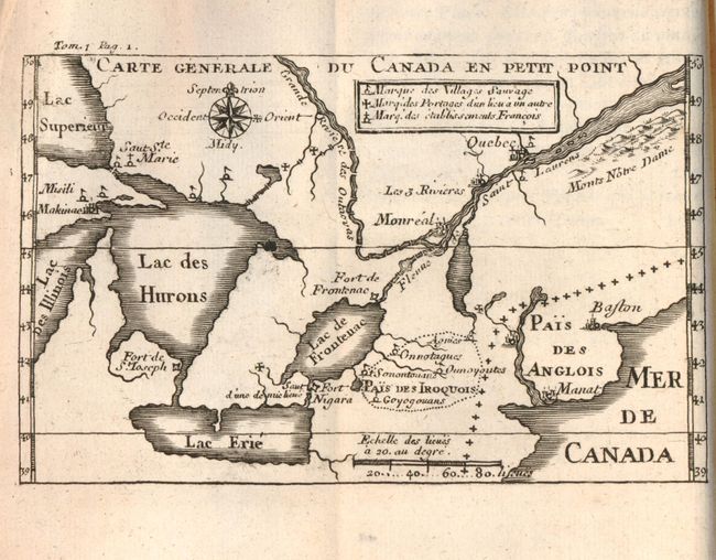
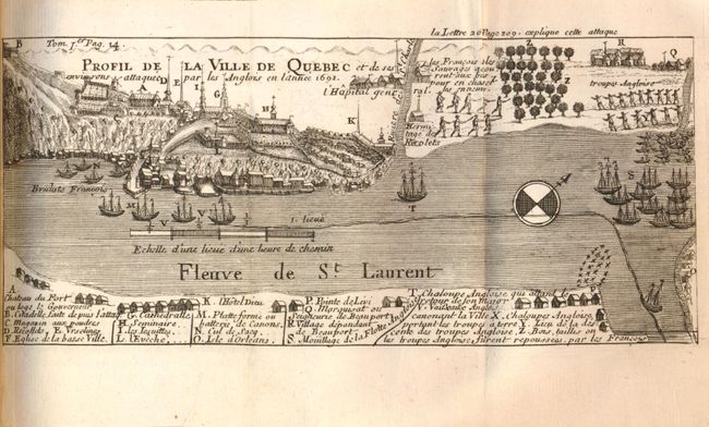
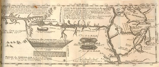
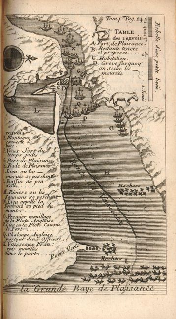
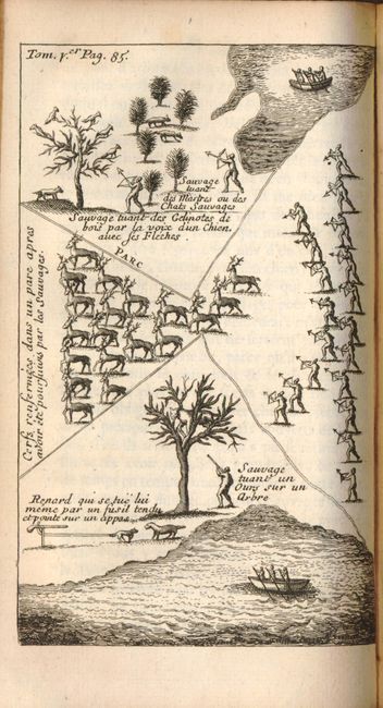
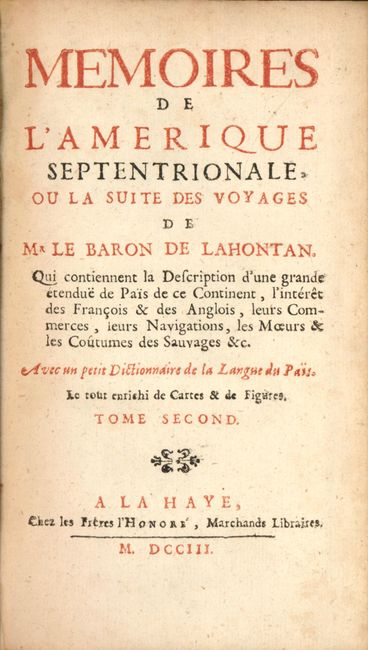
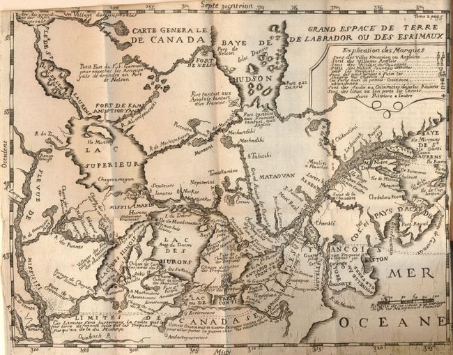
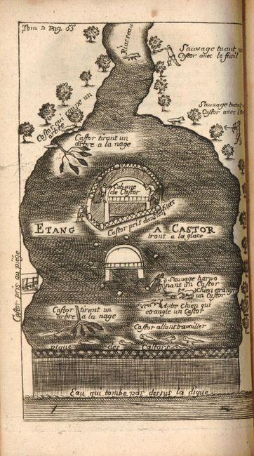
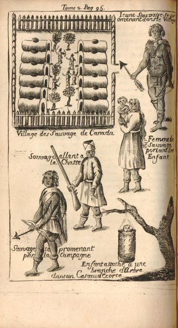
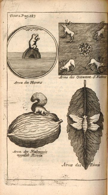
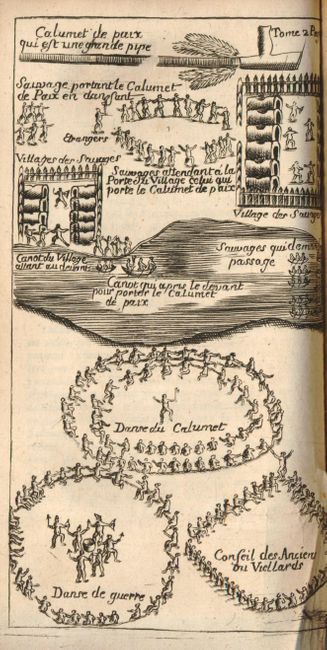
"[Lot of 2] Nouveaux Voyages de Mr le Baron de Lahontan, dans l'Amerique Septentrionale… Tome Premier … 1704 [and] Memoires de l'Amerique Septentrionale … Tome Second … 1703", Lahontan, Louis Armand, Baron de

Subject: Colonial Canada & United States, Exploration

Period: 1703-1704 (dated)

Publication:

Color: Black & White

Size:
4 x 6.5 inches
10.2 x 16.5 cm
Download High Resolution Image
(or just click on image to launch the Zoom viewer)

Volume 1 (Tome Premier) is the 1704 French edition. It contains the small folding map (3.5 x 5.5") Carte Generale du Canada en Petit Point (Ref: Kershaw No. 283) which shows the Great Lakes, Boston, Manhattan (Manat) and the Saint Lawrence. Also locates the lands of the Iroquois, Fort Niagara, Fort de S. Joseph, Sault Ste. Marie, Montreal and Quebec. The map has "Tom 1 Pag.1" at upper left, an accent of the "e" in Erie and a few other details that identify this as State One. The next plate is a great bird's-eye view of Quebec (8 x 3.6") Profil de la Ville de Quebec with extensive key below locating important buildings. The river is filled with French ships and the fleet of the British slightly down river. The large folding map (11.5 x 5") Carte que les Gnacsitares ont Dessine sur…/ Carte de la Riviere Longue et de Quelques Autres… (Ref: Kershaw No. 301) is one of the most influential, and fanciful maps in American cartographic history. It purports to show the Riviere Longue flowing from the mountains in the west, home to the Gnacsitares Indians, and connecting to the Mississippi River. On the western side of the mountains is another river, presumably flowing into the Pacific. Lahontan's concept was copied by virtually all 18th century cartographers including Moll, Senex, Popple, and Delisle, thus perpetuating the myth. The map also includes balloon-shaped Lakes Superior and Michigan. This is the rare first state with "Tom 1er Pag. 136" at upper right. This first state has several differences with later maps including Mississippi written as Missisippi. Complete with 13 engravings and maps, 280 pp. Bound in original full brown calf, spine tooled in gilt with raised bands.

Volume 2 (Tome Second) is the first French edition of this important book. It includes the Petit Dictionaire de la Langue des Sauvages, a very early Algonquin and Huron dictionary, the boldly engraved folding map Carte Generale de Canada showing Canada, New England and the Great Lakes with numerous spurious waterways. Complete with 10 engravings, 210 pp. + 17pp index. Bound in original full brown calf, spine tooled in gilt with raised bands. Louis Armand, Baron de Lahontan served ten years in the French military in Canada, was involved in the Indian Wars, and commanded several posts in the west. He traveled extensively in the Wisconsin and Minnesota region and the upper Mississippi Valley. Upon his return to Europe he wrote this enormously popular travelogue. In it he embellished his knowledge of the geography of the Great Lakes region, invented Indian tribes, and created several fictions, particularly the River Longue, which he claimed extended from the Mississippi River to the Rocky Mountains. Over twenty editions of his book were published between 1703 and 1741, including editions in French, English, Dutch and German. The immense popularity of the book resulted in his distorted cartography being accepted by several eminent cartographers who incorporated the "Lahontan" concepts into most 18th century maps.

References: Vol II Map - Kershaw #291; Karpinski (MI) plt. VIII; McCorkle #703.2.

Condition: A

The text pages and plates are generally very good. The bindings are good with a little shelf and age wear, and both spine front edges showing signs of stress. Volume I has a stain on the front cover.

Estimate: $2,750 - $3,250

Sold for: $4,000

Closed on 2/16/2011

Archived