Catalog Archive
Auction 135, Lot 106

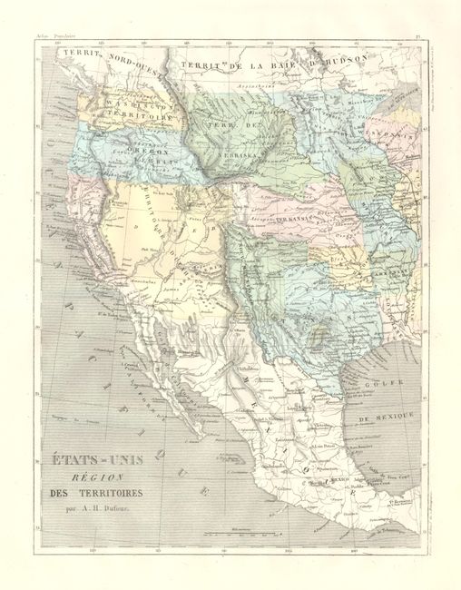
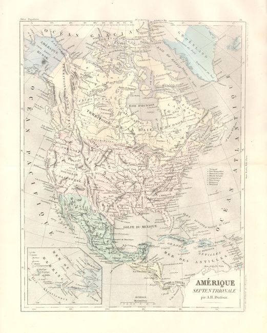
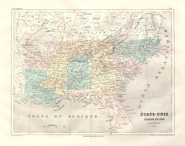
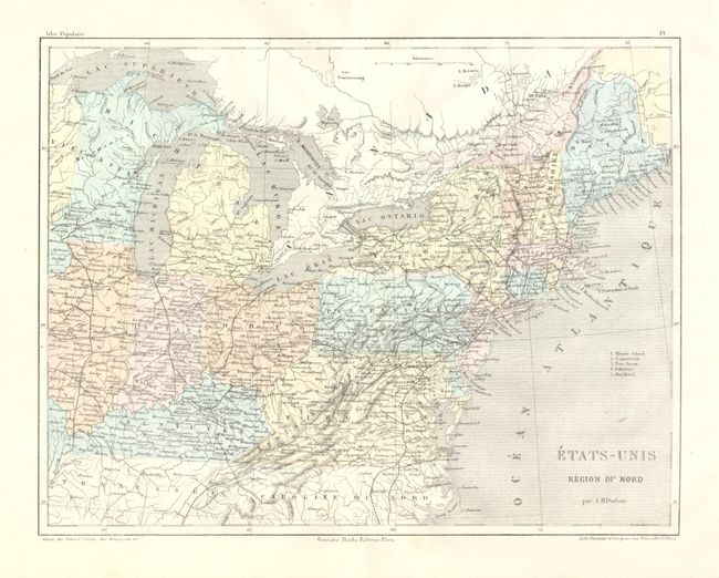
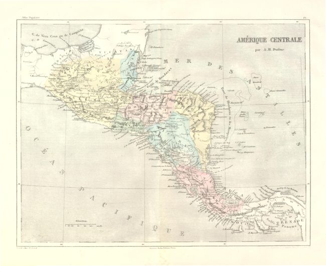
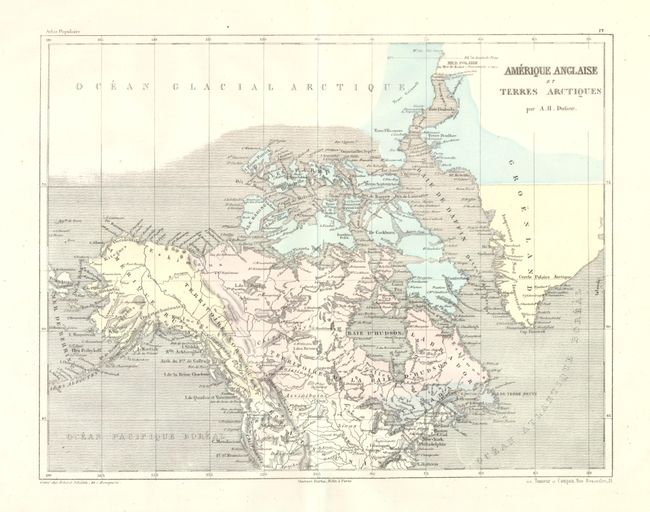
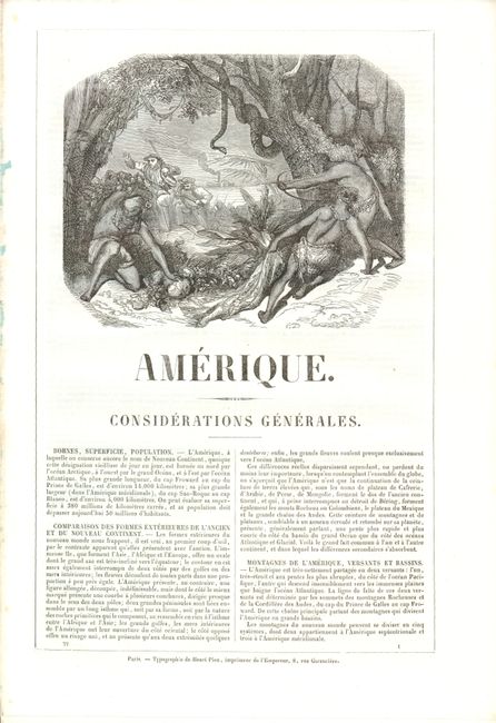
"[Lot of 6 - North America]", Malte-Brun, Conrad

Subject: North America

Period: 1860 (circa)

Publication: Geographie Universelle de Malte-Brun Illustree

Color: Hand Color

Size:
8.3 x 11.5 inches
21.1 x 29.2 cm
Download High Resolution Image
(or just click on image to launch the Zoom viewer)

This lot includes six maps from Malte-Brun's atlas. Includes the original blue paper pictorial mailing wrappers (8.5" x 11.6") titled, Geographie Universelle de Malte-Brun Illustree…Accompagnee d'un Nouvel Atlas Populaire… America. This atlas was issued in parts, mailed to the subscriber, who then could choose to have them bound or not.

Etats-Unis Region des Territoires. This map of the western territories depicts several incorrect boundaries, suggesting an older map than we have here. Nouveau Mexique is shown with the approximate boundaries of the old Spanish territory. The huge Utah Territory encompasses all of present day Nevada, Utah, Colorado, Arizona and part of New Mexico. Its boundary with California lies along the Sierra Nevada range. The small settlement of Arizona lies in the southern portion near the Mexican border. Nebraska Territory occupies the region between the Platte River and Canada, and from the Rocky Mountains to the Missouri River. Kansas Territory takes in present day Kansas, Nebraska and part of Colorado. The map shows the Gadsden Purchase boundary between the U.S. and Mexico. This map also notes a large German colony in the area of Fredericksburg, in central Texas. Fredericksburg was founded by German immigrants under the auspices of the Society for the Protection of German Immigrants in Texas. In 1846, John O. Meusebach led 120 fellow Germans into the area between the banks of the Llano and Colorado Rivers. Meusebach named the colony for Prince Frederick of Prussia. Immediately below this colony is located a French colony. Both colonies are rarely depicted.

Etats-Unis Region du Sud. Shows the southern states from North Carolina to Louisiana. Arkansas is in its statehood configuration. Georgia is in an odd configuration, extending far to the north between Alabama and North Carolina. The Gold Region is located in the vicinity of Canton, north of today's Atlanta.

Etats-Unis Region du Nord. Good detail throughout to include wagon roads and many railroads. The National Road is delineated but not named.

Amerique Septentrionale. Pre-Gadsden Purchase boundary, Alaska is Amerique Russe. Inset extends southwestern Alaska and the Aleutian Chain.

Amerique Anglaise et Terres Arctiques. This map of Canada names only four regions: Canada, the territories of the Northwest and Hudson Bay, and Labrador. The Northwest Territory extends from today's Yukon south along the coast to the border with the United States. Includes part of Greenland and locates the region north of Baffin Bay named Terre Grinnell.

Amerique Centrale. Delineates Belize, Guatemala, Honduras, S. Salvador, Nicaragua and Costa Rica. The Isthmus area is uncolored and unnamed, but Panama [City] is named. The entire region has an extensive road network that extends to Panama.

References:

Condition: A+

The maps are fine. Text pages and engravings are very good to fine. Blue paper covers are a little spotted and back cover is loose.

Estimate: $300 - $350

Sold for: $150

Closed on 2/16/2011

Archived