Catalog Archive
Auction 134, Lot 99

"L'Amerique Septentrionale qui fait partie des Indes Occidentales…", Chiquet, Jacques

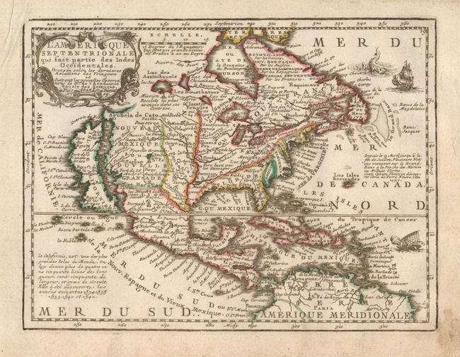
Subject: North America

Period: 1719 (dated)

Publication:

Color: Hand Color

Size:
8.7 x 6.6 inches
22.1 x 16.8 cm
Download High Resolution Image
(or just click on image to launch the Zoom viewer)

East and West Florida underwent several boundary and sovereignty changes during its history. The two regions were established in 1763 by the British colonial government out of land taken from France and Spain after the French and Indian War. Reasoning the newly acquired territory too large to govern, the British divided it into two new colonies separated by the Apalachicola River. West Florida was based in Pensacola, and the colony included the part of formerly Spanish Florida west of the Apalachicola, plus the parts of French Louisiana taken by the British. Its northern boundary shifted several times over the years. East Florida has as its capital St. Augustine, which had been the capital of Spanish Florida. Both remained loyal to the British crown during the Revolutionary War, and served as havens for Tories fleeing the Thirteen Colonies. In 1781 Spain invaded West Florida and captured Pensacola, leading Britain to cede both to Spain following the war. The ill defined boundaries led to a series of border disputes between Spain and the nascent United States known as the West Florida Controversy. Disagreements with the Spanish government led settlers along the gulf coast to declare the area the independent Republic of West Florida in 1810. The area was soon annexed by the United States, claiming the region as part of the Louisiana Purchase. The remainder of West Florida and all of East Florida were purchased by the United States in 1819 under the terms of the Adams–Onís Treaty. Florida Territory was formed as a result.

Charming, exquisitely detailed map of the continent featuring the island of California with an indented northern coast and Cap Blanc, Port des Roys and Pointe de la Cair at its northern end. The British colonies are shown confined east of the Appalachians, with France in control of the region between there and the Mississippi River. Spain controls all of the West and Florida. The decorative title cartouche is flanked by two serpents. Two ships and a sea monster fill the Atlantic.

References: McLaughlin #191.

Condition: B+

Good impression and color on full sheet with partial fleur-de-lys watermark. Some soiling or stain in blank margin mostly at lower right corner.

Estimate: $600 - $700

Sold for: $500

Closed on 12/1/2010

Archived