Catalog Archive
Auction 134, Lot 748

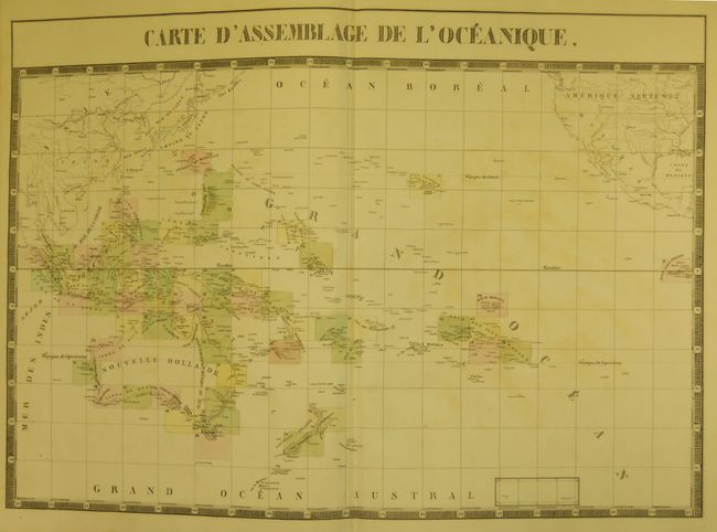
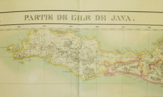
"Atlas Universel de Geographie Physique, Politique, Statistique et Mineralogique...Sixieme Partie - Oceanique", Vandermaelen, Philippe Marie Guillaume

Subject: Atlases, Pacific Ocean

Period: 1827 (dated)

Publication:

Color: Hand Color

Size:
15 x 21.5 inches
38.1 x 54.6 cm
Download High Resolution Image
(or just click on image to launch the Zoom viewer)

Vandermaelen was the son of a wealthy industrialist who abandoned his father's business to follow a career in cartography. His goal was to produce the first atlas ever published in which every map was drawn on the same projection and to the same scale (1: 1,641,836), with each map covering an area of approximately 20 degrees of longitude (from Paris) and 6 degrees of latitude. Because of the consistent scale and projection, the maps could be joined together to form a huge globe that would measure over 25 feet in diameter. Vandermaelen had the only known globe constructed from his maps, requiring a special room for its display. It was also the first lithographic atlas ever published. There was one edition of the atlas, published in 1825-27, and the subscription list shows that only 810 copies were sold. Koeman called his Atlas Universel, "One of the most remarkable world atlases ever made. Far ahead of its time."

This is a fine and complete example of Vandermaelen's Pacific Ocean volume (Sixth of Six). Each large double page folio map is beautifully hand colored and measures approximately 22" x 19". The first map is the index map "Carte D’Assemblage de L’Oceanique." It shows the region covered by each of the following maps. The next maps, numbered No. 1 though 60, show Australia and Tasmania, New Zealand, the East Indies, the Philippines, Malaysia and all of the southern Pacific Islands including Hawaii. Map No. 12 is missing which, according to the index sheet, covers Singapore, the southern part of Malay peninsula and a small part of Sumatra. Each map is drawn on the same scale and shows remarkable detail. The atlas contains 60 charts, each surrounded by a bold block-style border. Bound in original brown speckled boards with quarter brown calf on tips and spine with raised ribs and gilt tool work. Original red and black leather labels on spine with gilt titling. Finely marbled end papers. Two title pages, sixty maps of sixty-one. The fine lithography was accomplished from Paris by H. Ode. A rare and remarkable atlas that should be in any serious atlas collection.

References:

Condition: B+

All of the maps are very good to fine. The covers are generally very nice but with tips rubbed as is the edge of spine. Front of spine is starting to crack and upper 1/2" is missing. Some water staining to the title pages.

Estimate: $5,000 - $6,000

Sold for: $3,000

Closed on 12/1/2010

Archived