Catalog Archive
Auction 134, Lot 617

"L'Asie Divisee en ses Principales Regions…", Sanson/Jaillot
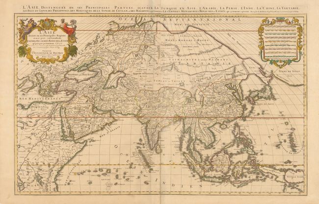
Subject: Asia

Period: 1689 (circa)

Publication: Atlas Nouveau

Color: Hand Color

Size:
34.4 x 21.5 inches
87.4 x 54.6 cm
Download High Resolution Image
(or just click on image to launch the Zoom viewer)

Originally a sculptor, Alexis-Hubert Jaillot began his career in map-making after marrying the daughter of Nicolas Berey. His skill as an engraver and his business acumen brought him to the attention of Nicolas Sanson's heirs, who hired him to breath new life into their business at about the same time that Blaeu's important printing works was destroyed by fire. Jaillot re-engraved Sanson' important maps on an enlarged scale and published them first in Paris and later printed by Pierre Mortier in Amsterdam. This expansive map of Asia is one of the largest and most impressive general maps of the continent. It is based on Sanson's 1650 map, but Jaillot updated the northeastern coastline from DuVal's map of 1670. The island of Hokkaido is attached to the mainland as part of the Yupi peninsula and a huge Terre de Iesso (the name normally associated with Hokkaido) appears to the east. Korea is shown as an elongated peninsula. In the East Indies, New Guinea is divided into Terre de Papous and Nouvelle Guinee. This is an early Paris edition. Printed on two joined sheets, as issued.

References: Yeo #76.

Condition: A

Nice impression and original color with a couple minor spots, still overall very good.

Estimate: $900 - $1,200

Sold for: $650

Closed on 12/1/2010

Archived