Catalog Archive
Auction 134, Lot 57

"A Map of the Countries Situate about the North Pole, as far as the 50th Degree of North Latitude", Carey, Mathew
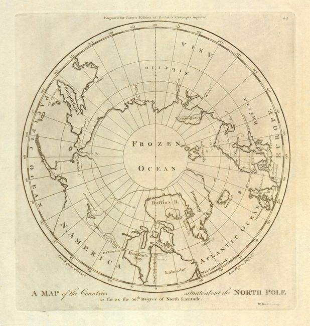
Subject: North Pole

Period: 1799 (circa)

Publication: General Atlas

Color: Black & White

Size:
9.4 x 9.4 inches
23.9 x 23.9 cm
Download High Resolution Image
(or just click on image to launch the Zoom viewer)

Mathew Carey was a seminal figure in early American publishing; establishing the first publishing firm to specialize in cartography and issuing the first atlas devoted exclusively to American maps. He set up an elaborate cottage system of craftsmen for compiling, engraving, printing, and coloring maps. This practice was emulated by later American cartographic publishers such as John Melish and Henry S. Tanner. The American Atlas concept was also adopted by other publishers in both the United States and Europe.

This is the first map of the North Pole published by an American cartographer. The map illustrates information from the late eighteenth century explorations in the Canadian north by Hearne and Mackenzie.

References: Wheat & Brun #915.

Condition: A

Estimate: $100 - $150

Unsold

Closed on 12/1/2010

Archived