Catalog Archive
Auction 134, Lot 53

"Fol. A.A.", Scherer, Heinrich
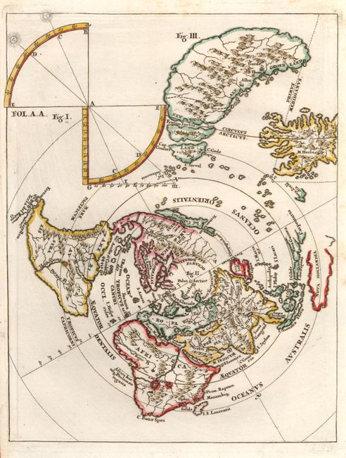
Subject: North Pole

Period: 1700 (circa)

Publication: Atlas Novus

Color: Hand Color

Size:
7.2 x 9.2 inches
18.3 x 23.4 cm
Download High Resolution Image
(or just click on image to launch the Zoom viewer)

This unusual little map presents the world on a north polar projection. California is shown as an island and there is a suggestion of a land bridge connecting North America (Anian) with Asia (Terra Iedso). There is a distorted portion of Australia noted as Nova Hollandia. It also includes an enlarged map of Greenland and Iceland, along with a diagram at top. Heinrich Scherer, professor of mathematics at Munich, was a devout Jesuit whose work emphasizes the Catholic hierarchy and the spread of Jesuit missions throughout the world.

References:

Condition: A

Margin extended at left to better accommodate framing.

Estimate: $200 - $250

Sold for: $150

Closed on 12/1/2010

Archived