Catalog Archive
Auction 134, Lot 432

"[Map of the City of Cork]", Stafford, Thomas

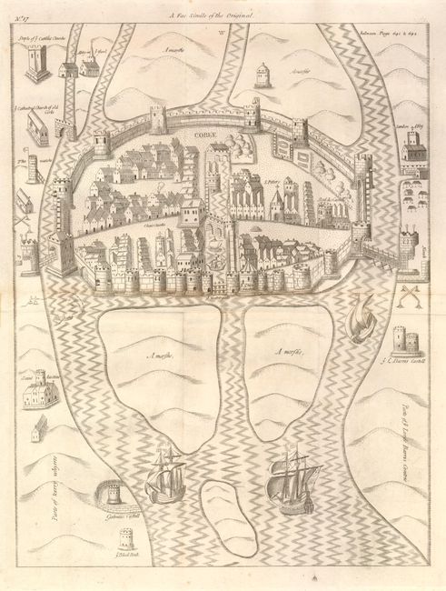
Subject: Cork, Ireland

Period: 1633 (circa)

Publication: Pacata Hibernia. Ireland appeased and reduced…

Color: Black & White

Size:
11.6 x 15.2 inches
29.5 x 38.6 cm
Download High Resolution Image
(or just click on image to launch the Zoom viewer)

This city plan is the 1810 restrike of the 1633 copper plates. The birds-eye view shows the walled and heavily fortified city of Cork with numerous battlements along the protective wall. Cannons are visible protruding from two towers. The town is surrounded by the water with access via bridges with protective iron gates. An interior waterway is blocked by an enormous moveable water gate. Large three-masted sailing ships rest in the foreground. Cork is depicted with individual buildings shown including St. Peters, the Queen's Castle, Christ Church and Skyddis Castle. No engraver credited. A scarce view.

References:

Condition: A

Image is very nice with just a little centerfold toning that is not distracting. Old tape at sides along centerfold and at top and bottom, well away from map image. Issued folding.

Estimate: $200 - $300

Sold for: $150

Closed on 12/1/2010

Archived