Catalog Archive
Auction 134, Lot 420

"Le Royaume d'Angleterre, distingue en ses Provinces", Jaillot, Alexis-Hubert

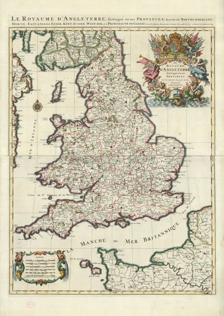
Subject: England & Wales

Period: 1693 (dated)

Publication:

Color: Hand Color

Size:
22.8 x 29.7 inches
57.9 x 75.4 cm
Download High Resolution Image
(or just click on image to launch the Zoom viewer)

This is the first state of this large, boldly engraved map of England and Wales. It is printed on two sheets and shows counties, major towns and topography. The large title cartouche is composed of trumpeting angels and mermen with the royal coat of arms, flags and military implements. Jaillot, in partnership with the sons of Nicolas Sanson, re-engraved Sanson's map on a larger scale in the 1680s. This particular map was published 20 years later, and while based on Sanson's cartography (who is credited in the cartouche), it is a Jaillot composition.

References: Shirley (BI) Jaillot 2.

Condition: B+

Nice impression with minor soil in the map. There are some minor defects in the wide margins, including some archival tape repairs. A small ink stamp of a previous owner (RWS) is in the bottom blank margin.

Estimate: $800 - $1,000

Unsold

Closed on 12/1/2010

Archived