Catalog Archive
Auction 134, Lot 419

"Angliae Regni Florentissimi Nova Descriptio, Auctore Humfredo Lhuyd Denbygiense", Ortelius, Abraham

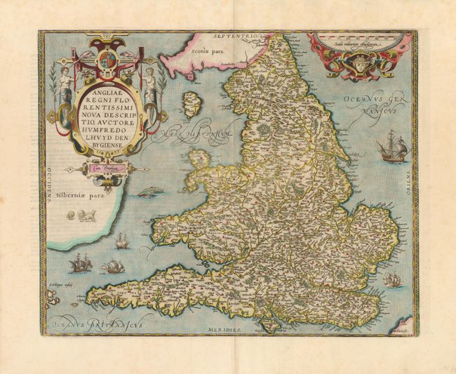
Subject: England & Wales

Period: 1573 (dated)

Publication: Theatrum Orbis Terrarum

Color: Hand Color

Size:
18.5 x 14.8 inches
47 x 37.6 cm
Download High Resolution Image
(or just click on image to launch the Zoom viewer)

Stunning map of England and Wales compiled from Mercator's 1564 wall map of the British Isles and Lhuyd's manuscript map of 1568. The countryside is fully engraved with topographical features and hundreds of towns. This map improved on Mercator's outline of the countries particularly in Cardigan and south Wales, the Devon peninsula, and the Wash and Humber inlets. Interestingly the Caernarvon peninsula, near Lhuyd's hometown of Denbigh, is badly distorted and it has been suggested that this may be due to his sketching it from one of the nearby mountains. Sea monsters and five sailing ships occupy the stipple engraved oceans. A flock of sheep is shown in Ireland and there are two large, elaborate cartouches. Dated 1573 in the cartouche and published in the French edition of 1598.

References: Van den Broecke #19.3; Shirley (BI) #100.

Condition: A

There is just a hint of foxing in the margins and the impression is a bit uneven.

Estimate: $1,000 - $1,300

Sold for: $1,100

Closed on 12/1/2010

Archived