Catalog Archive
Auction 134, Lot 359

"Al Sermo. Ferdinando II Granduca di Toscana suo Signore Don Roberto Dudleo Duca di Northumbria XII d'Ameri'a", Dudley, Robert (Sir)

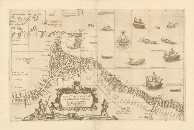
Subject: Venezuela and Guyana

Period: 1660 (published)

Publication: Dell Arcano del Mare

Color: Black & White

Size:
28.3 x 18 inches
71.9 x 45.7 cm
Download High Resolution Image
(or just click on image to launch the Zoom viewer)

One of Dudley' most decorative charts, this map of the coast of Guiana is adorned with fabulous engravings of ships, native canoes, fearsome sea monsters and shapely native maidens. The map covers the coastline from the Regno di Cubagua and Trinidad through Rio Corantijn with emphasis on the Orinoco Delta. Every river and creek along the coastline is shown with soundings, hazards and good anchorages carefully recorded. This is essentially an untitled chart; the cartouche contains the dedication Dudley's patron, the Duke of Tuscany. The distinctive calligraphy (alla cancellaresca), fine cartouche, and decorative elements are the work of the engraver, Antonio Francesco Lucini. Printed on two, joined sheets as issued.

Robert Dudley was the first Englishman to produce a sea atlas, Dell Arcano del Mare (Secrets of the Sea). He introduced a totally new style for sea charts in the atlas with only lines of latitude and longitude and no rhumb lines. The charts were meticulously compiled from original sources and were both scientific and accurate for the time. This important atlas was the first sea atlas of the whole world; the first to use Mercator's projection throughout; the earliest to show the prevailing winds, currents and magnetic deviation; and the first to expound the advantages of Great Circle Sailing. In an introductory leaf found in one copy in the British Library, the engraver states that he worked on the plates in seclusion for twelve years in an obscure Tuscan village, using no less than 5,000 pounds of copper for the printing plates. It was only issued in two editions and the maps are rarely seen on the market. This map is from the second edition.

References:

Condition: A+

Fine impression with wide original margins.

Estimate: $2,400 - $3,000

Sold for: $2,000

Closed on 12/1/2010

Archived