Catalog Archive
Auction 134, Lot 322

"Insularum Hispaniolae et Cubae cum Insulis Circumjacentibus Accurata Delineatio", Jansson, Jan

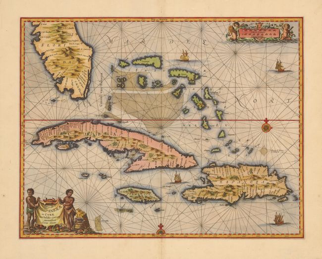
Subject: Bahamas and Greater Antilles

Period: 1657 (published)

Publication: Novus sive Theatrum…

Color: Hand Color

Size:
20.8 x 16.2 inches
52.8 x 41.1 cm
Download High Resolution Image
(or just click on image to launch the Zoom viewer)

The first state of this striking sea chart that includes the southern tip of Florida, the Bahamas, Cuba, Jamaica and Hispaniola. It is one of the first Dutch maps to feature the region on a large scale, due to the importance of the Canaal van Bahama, which was used to transport Spanish gold and silver from the New World. The cartography is based on the extremely rare Hessel Gerritsz chart of 1631, with the addition of five place names in Florida. Jansson also depicts a spurious mountain range in Florida, taken from the much earlier De Bry map. The map is embellished with a pictorial title cartouche and scale of miles, rhumb lines, galleons and two compass roses.

References: Burden #291.

Condition: A

Overall very good with just a hint of toning.

Estimate: $1,600 - $2,000

Unsold

Closed on 12/1/2010

Archived