Catalog Archive
Auction 134, Lot 321

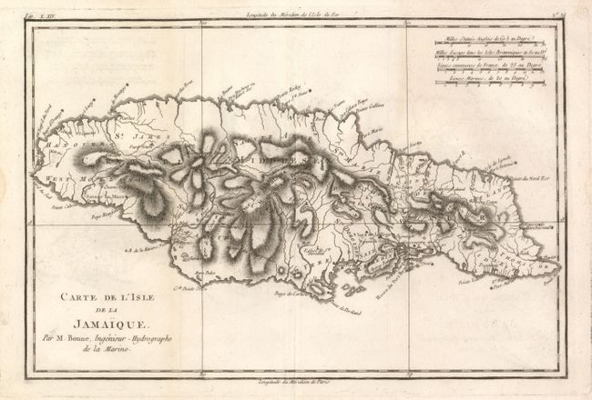
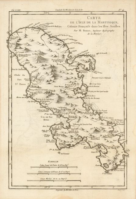
"[Lot of 2] Carte de l'Isle de la Jamaique [and] Carte de l'Isle de la Martinique Colonie Francoise dans les Isles Antilles", Bonne, Rigobert

Subject: Caribbean Islands

Period: 1780 (circa)

Publication: Raynal's Histoire Philosphie du Commerce des Indes

Color: Black & White

Size:
12.6 x 8.5 inches
32 x 21.6 cm
Download High Resolution Image
(or just click on image to launch the Zoom viewer)

Two nice, copper engraved maps of Jamaica and Martinique. Both provide great topographical detail and the locations of settlements, ports, and forts. Rigobert Bonne was an important French cartographer of the late 18th century. In 1773 he succeeded Jacques Bellin as the royal cartographer in the office of the Hydrographer at the Depot de la Marine. Working in his official capacity, Bonne compiled some of the most detailed and accurate maps of the period.

References:

Condition: A

Sharp impressions with faint offsetting, which erases easily. There are some light damp stains in the blank margins

Estimate: $130 - $180

Sold for: $65

Closed on 12/1/2010

Archived