Catalog Archive
Auction 134, Lot 316

"A New Map of the English Empire in the Ocean of America or West Indies", Browne, Christopher
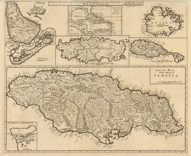
Subject: Caribbean

Period: 1690 (circa)

Publication:

Color: Black & White

Size:
23.8 x 19.8 inches
60.5 x 50.3 cm
Download High Resolution Image
(or just click on image to launch the Zoom viewer)

This is the rare first edition of this composite sheet with eight maps of Britain's colonial possessions in the West Indies. At top is a small Generall Chart of the West Indies and at bottom is a large New Map of the Island of Jamaica with an inset map of Port Royal harbor. The map of Jamaica shows its parishes with very fine detail and notations throughout. Arrayed at top are maps of Barbados (with an inset of Bridgetown), Antigua, St. Kitts, Tobago and Bermuda. The later revised editions from John Senex's New General Atlas are more frequently on the market, though still uncommon. We cannot find any sales records for the Browne edition in 30 years of price records.

References:

Condition: A+

Sharp, early impression with a couple tiny repaired edge tears in top margin.

Estimate: $850 - $1,000

Sold for: $1,300

Closed on 12/1/2010

Archived