Catalog Archive
Auction 134, Lot 29

"Planisphaerium Terrestre cum Utroque Coelesti Hemisphaerio, sive Diversa Orbis Terraquei…", Zurner, Adam Friedrich
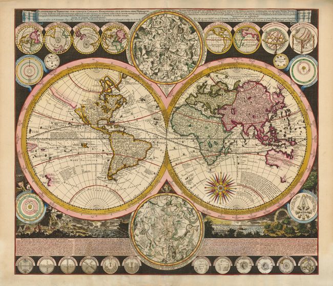
Subject: World

Period: 1700 (circa)

Publication:

Color: Hand Color

Size:
22.8 x 20 inches
57.9 x 50.8 cm
Download High Resolution Image
(or just click on image to launch the Zoom viewer)

This is a stunning double hemisphere world map with up-to-date cartography for the period. California is shown as an island with an indistinct Fretum Anian and Terra Esonis above it. There is a River of the West emptying into a small sea just northeast of California. Australia is shown to be separate from New Guinea, Carpentaria and Diemens Land. Nova Britannia is shown as a separate island off the coast of New Guinea with the notation that it was discovered by Dampier in 1700. Several explorer's tracks are traced, including Magellan, Dampier, Tasman, Gaetani and Charmont. The map is enclosed in broad bands containing information on the winds and climates. Tucked between the hemispheres are beautiful celestial maps and arrayed throughout the border are twenty-six smaller astronomical diagrams and world maps on various projections. At the bottom is a panorama illustrating tempests, earthquakes, tides, vortices, volcanoes with a textual commentary on the natural phenomena depicted.

References: Shirley #639.

Condition: A

Very sharp impression with old and slight refreshed color. There are a few very minor repairs on the centerfold.

Estimate: $4,750 - $5,500

Sold for: $4,000

Closed on 12/1/2010

Archived