Catalog Archive
Auction 134, Lot 297

"Vereinigte Staaten von Nord-America: Californien, Texas und die Territorien New Mexico u. Utah…", Meyer, Joseph

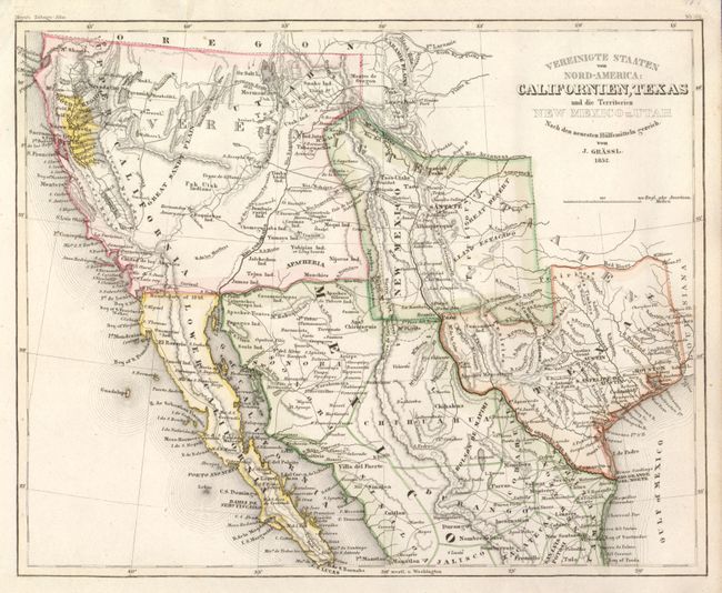
Subject: Southwest United States, Texas & Mexico

Period: 1852 (dated)

Publication: Meyer's Zeitungs-Atlas

Color: Hand Color

Size:
11 x 9 inches
27.9 x 22.9 cm
Download High Resolution Image
(or just click on image to launch the Zoom viewer)

This terrific map of the southwestern U.S. and northern Mexico is filled with place names, Indian tribes, routes of exploration, wagon roads, and more. Of special interest is a huge Gold Region in Northern California, here highlighted in yellow. Nueva Helvetia still exists north of Sacramento City. The Southwest and California is called Upper California and the Baja is Lower California. Lake Tahoe is barely visible and is named Mountain Lake, while the Great Basin is labeled the Great Sandy Plains. Utah is a vague but named area in the northeast portion of Upper California. The Great Salt Lake and Utah Lake are misshapen but correctly located. Salt Lake City (here Mormon City) is incorrectly located at the southern tip of the Great Salt Lake. New Mexico is oddly shaped, at the expense of Texas, and contains several towns that properly belong in Mexico, the balance of the border is pre-Gadsden Purchase following the Gila River. The mapping of Texas is very detailed. Locates Austin's Grant, Houston, Austin, S. Antonio de Bexar, and more.

References: cf Wheat (Gold) # 217

Condition: A

The map is clean and bright with no foxing or soiling and very nice hand color. There is a short closed tear in the upper margin else is near fine.

Estimate: $200 - $250

Sold for: $150

Closed on 12/1/2010

Archived