Catalog Archive
Auction 134, Lot 226

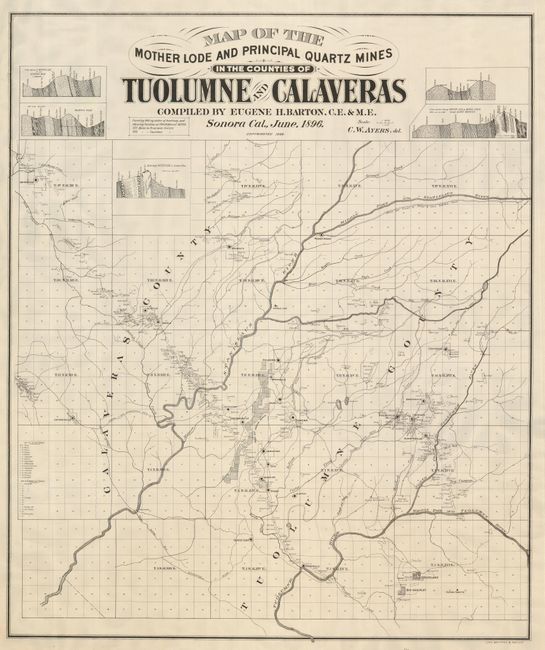
"Map of the Mother Lode and Principal Quartz Mines in the Counties of Toulumne and Calaveras…", Britton & Rey

Subject: California

Period: 1896 (dated)

Publication:

Color: Black & White

Size:
33 x 39.5 inches
83.8 x 100.3 cm
Download High Resolution Image
(or just click on image to launch the Zoom viewer)

This large map shows the most important mining district in California and is a fascinating look at late l9th Century California Gold Mining. The detailed map is centered on Columbia and names 510 mines. It covers over 800 square miles and extends from San Andreas in the northwest to Groveland and Big Oak Flat. The map is also notable as being a very late Britton & Rey imprint. Compiled by Eugene H. Barton, C.E. & M.E. Sonora, California, June 1896, engraved by W.W. Ayers, and published in San Francisco.

References:

Condition: A

Very clean with a minor damp stain in the bottom margin. The map has been professionally backed with light Japanese tissue. There are some minor edge tears, well away from the map.

Estimate: $450 - $550

Sold for: $325

Closed on 12/1/2010

Archived