Catalog Archive
Auction 134, Lot 205

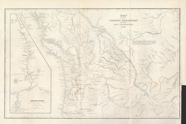
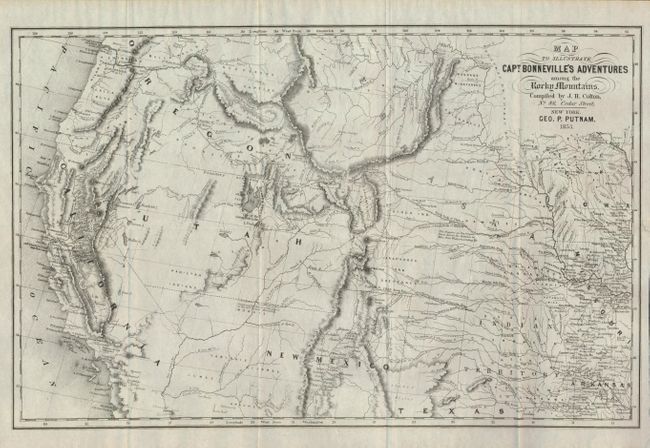
"[Lot of 2] Map of the Oregon Territory from the Best Authorities [and] Map to Illustrate Capt. Bonneville's Adventures among the Rocky Mountains",

Subject: Western United States

Period: 1849-53 (dated)

Publication:

Color: Black & White

Size:
See Description
Download High Resolution Image
(or just click on image to launch the Zoom viewer)

The United States and Great Britain established in 1818 joint claim over the Oregon Territory - the region north of Spanish controlled Upper California up to the southern boundary of Russia's Alaska Territory at North latitude 54°40'. By the late 1830's this arrangement was beginning to fall apart. In the 1840's the expansionist Democrats, including their 1844 presidential candidate, James Polk, claimed the entire region for the United States. Their expansionist desires were expressed by Polk's famous campaign slogan, "Fifty-four Forty or Fight!" The slogan also became a rally cry for Americans desiring to settle the territory. Following Polk's election, the dispute was resolved by the 1846 Treaty of Oregon, which struck a compromise that fixed the U.S./Canadian boundary at 49º North.

1) Map of the Oregon Territory from the Best Authorities, by Charles Wilkes, from Astoria or Anecdotes of an Enterprise beyond the Rocky Mountains, 1849, (13.2 x 8.3"). This is the reduced edition of Wilkes' map that was a major contribution to American cartography and the most detailed map of the region north of the Sacramento River. It provided Americans with an accurate view of an area still virtually unknown in the mid-nineteenth century. Wilkes supported the view of Senator Lewis Linn that the northwest boundary of America should extend into British America, the famous Fifty-four Forty or Fight controversy. This map was used to illustrate that his claim was based on 'topographical' grounds and was instrumental in setting the scene for American interests in the territory. The map covers the region from Fraser's Fort and Fort St. James in British Columbia south to the upper Sacramento River, and from the Pacific coast to the Black Hills east of the Rocky Mountains. The map provides excellent detail of the region including dozens of forts, watershed and other place names. A large inset map "Columbia River Reduced from a survey made by the U.S. ex. Ex. 1841" depicts the river from Ft. Walla Walla to its mouth, where one of Wilkes' ships, the Peacock, was lost on the infamous Columbia Bar. It also features details of missions, Indian villages, and the major mountains. North is oriented to the left.

2) Map to Illustrate Capt. Bonnevilles's Adventures among the Rocky Mountains, by Putnam/Colton, from Irving's Adventures of Captain Bonneville, 1853, 17.5 x 11.3"). This interesting map is based on Fremont's map of the same period. The region west of the Mississippi to the Pacific Ocean is delineated with the new gold region of California and a notation of Sutter's Fort. The expedition route described is that of Captain Benjamin Bonneville who explored the American West from 1832-1836. The expedition party traveled parallel to the course of the Snake and the Columbia rivers, going as far as Fort Walla Walla before turning back. Fremont's route through California is shown, as well as Kearny's route along the Gila River. Compiled by J.H. Colton, 86 Cedar St., New York.

References: 1) Wheat (TMW) #655; Hayes 199.

Condition: A

Both are very nice. The former has a short binding trim tear, closed on verso. The latter is virtually flawless.

Estimate: $350 - $450

Sold for: $210

Closed on 12/1/2010

Archived