Catalog Archive
Auction 134, Lot 187

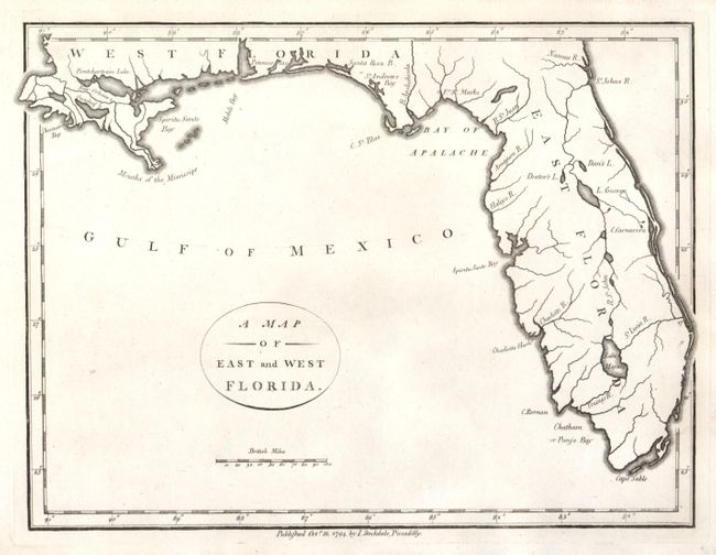
"A Map of East and West Florida", Stockdale, John

Subject: Southern United States, Florida

Period: 1794 (dated)

Publication: American Geography

Color: Black & White

Size:
9 x 6.7 inches
22.9 x 17 cm
Download High Resolution Image
(or just click on image to launch the Zoom viewer)

East and West Florida underwent several boundary and sovereignty changes during its history. The two regions were established in 1763 by the British colonial government out of land taken from France and Spain after the French and Indian War. Reasoning the newly acquired territory too large to govern, the British divided it into two new colonies separated by the Apalachicola River. West Florida was based in Pensacola, and the colony included the part of formerly Spanish Florida west of the Apalachicola, plus the parts of French Louisiana taken by the British. Its northern boundary shifted several times over the years. East Florida has as its capital St. Augustine, which had been the capital of Spanish Florida. Both remained loyal to the British crown during the Revolutionary War, and served as havens for Tories fleeing the Thirteen Colonies. In 1781 Spain invaded West Florida and captured Pensacola, leading Britain to cede both to Spain following the war. The ill defined boundaries led to a series of border disputes between Spain and the nascent United States known as the West Florida Controversy. Disagreements with the Spanish government led settlers along the gulf coast to declare the area the independent Republic of West Florida in 1810. The area was soon annexed by the United States, claiming the region as part of the Louisiana Purchase. The remainder of West Florida and all of East Florida were purchased by the United States in 1819 under the terms of the Adams–Onís Treaty. Florida Territory was formed as a result.

This boldly engraved map covers East and West Florida to the Mississippi River. Locates Pensacola, Ft. St. Marks and New Orleans. Locates Lake Pontchartrain, Ascension Bay, Cape Sable and names numerous rivers in the region that extends north as far as Nassau River on the Atlantic coast. Tampa Bay is here named Spiritu Santo Bay. The map does not extend to show any of the Keys beyond Cape Sable. Simple oval title cartouche and distance scale with British Statute Miles. No engraver is credited. Stockwell's imprint beneath the neatline "Oct. 18, 1794, by I. Stockdale, Piccadilly."

References:

Condition: A+

Beautiful, early impression with some text layout lines still evident.

Estimate: $250 - $300

Sold for: $375

Closed on 12/1/2010

Archived