Catalog Archive
Auction 134, Lot 138

"Extract from a Map of the British and French Dominions in North America by Jno. Mitchell", U.S. Government

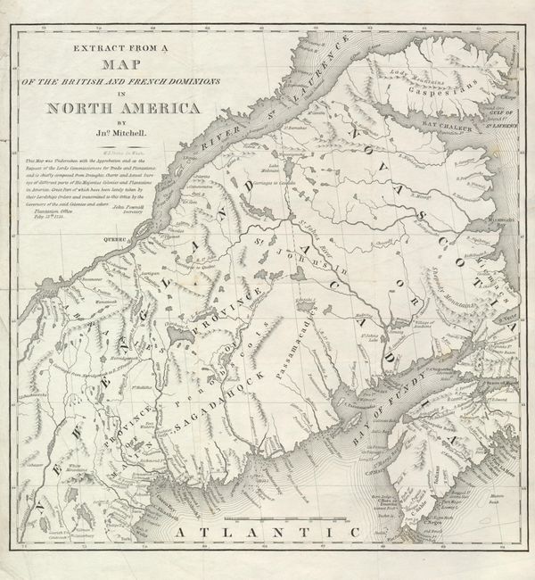
Subject: Canada & Maine

Period: 1843 (circa)

Publication:

Color: Black & White

Size:
13 x 13.3 inches
33 x 33.8 cm
Download High Resolution Image
(or just click on image to launch the Zoom viewer)

This map shows the region that was disputed between the United States and Canada prior to the border being established with the Webster-Ashburton Treaty of 1842. This is a copy of a section of John Mitchell's famous map that was used during the 1783 Treaty of Paris. That treaty did not clearly determine the boundary leaving a contested area of the Saint John River valley and its tributaries. In 1838-39 a confrontation, known as the Arroostook War, broke out between the United States and Great Britain. The dispute resulted in a mutually accepted border between the state of Maine and the provinces of New Brunswick and Quebec. The final treaty gave Maine most of the disputed area, and gave the British a militarily vital connection between Quebec and Nova Scotia by way of the Halifax Road. This map was issued in a government report on the conflict.

References:

Condition: B+

Issued folded, now flattened with a few minor creases.

Estimate: $110 - $150

Sold for: $180

Closed on 12/1/2010

Archived