Catalog Archive
Auction 134, Lot 131

"A Map of the Brittish-Plantations on the Continent of America", Salmon, Thomas

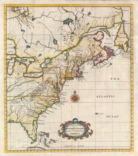
Subject: Colonial Canada & United States

Period: 1760 (circa)

Publication: A Brief Account of the War in North America

Color: Hand Color

Size:
11.8 x 13.5 inches
30 x 34.3 cm
Download High Resolution Image
(or just click on image to launch the Zoom viewer)

An uncommon map with information derived from Popple's large map of 1733. It shows the area from Labrador and Hudson Bay to Florida, and west to the Great Lakes. It is crisply engraved, and names the Province of Main, and Massachusets Bay for Massachusetts. Pennsylvania is shown extending to the 43rd parallel. Near present-day Nashville, Tennessee a note mentions that the area is A Fit Place for an English Factory. This map first appeared in Salmon's Modern History circa 1736. This edition is from Peter Williamson's work on the French and Indian War.

References: McCorkle #736.1.

Condition: B

Issued folded, now flattened with the binding trim replaced to accommodate framing. A clean 3" binding tear and a small tear between the tip of Florida and Cuba have been neatly repaired with tissue on verso.

Estimate: $375 - $450

Sold for: $425

Closed on 12/1/2010

Archived