Catalog Archive
Auction 134, Lot 112

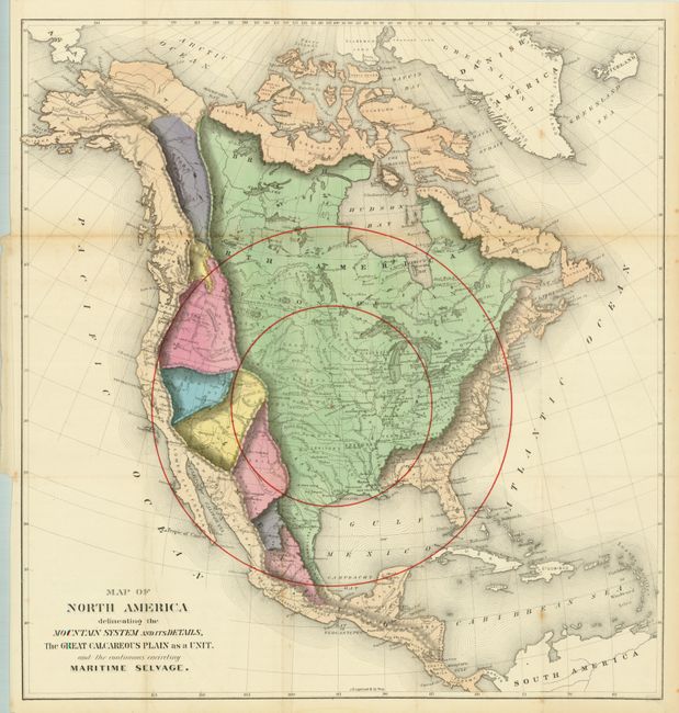
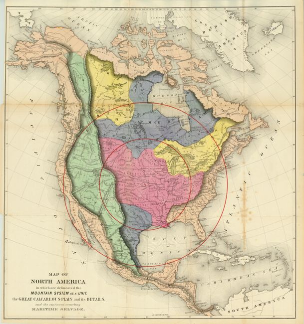
"[Lot of 2] Map of North America Delineating the Mountain System and its Details, the Great Calcareous Plain as a Unit… [and] Map of North America in which are Delineated the Mountain System as a Unit, the Great Calcareous Plain and its Details…", Gilpin, William

Subject: North America

Period: 1873 (published)

Publication: Mission of the North American People, Geographical, Social and Political

Color: Hand Color

Size:
22.3 x 23.8 inches
56.6 x 60.5 cm
Download High Resolution Image
(or just click on image to launch the Zoom viewer)

An uncommon set of maps drawn on the same base map. William Gilpin was the first governor of the state of Colorado and a proponent of the concept of Manifest Destiny, the transcontinental railway and a westward expansion of the United States. He had radical ideas on how America should be populated, and why, and to support his theories he did a series of maps including these two. Interestingly, they were some of the first to show economic potential for the West and to think in terms of regional resources and climates. The first map uses bold coloring to suggest related regions. The second map shows the West in a more granular view of the region. Both use concentric circles, which Gilpin used to represent the future population density with the center of population at Topeka, Kansas. Blank verso.

References:

Condition: B+

Folding as issued. Strong original hand coloring that is likely as bright as when issued. One with some spotting along right side fold, the other is very good.

Estimate: $300 - $400

Sold for: $375

Closed on 12/1/2010

Archived