Catalog Archive
Auction 133, Lot 87

"Nord America und West Indien", Meyer, Joseph

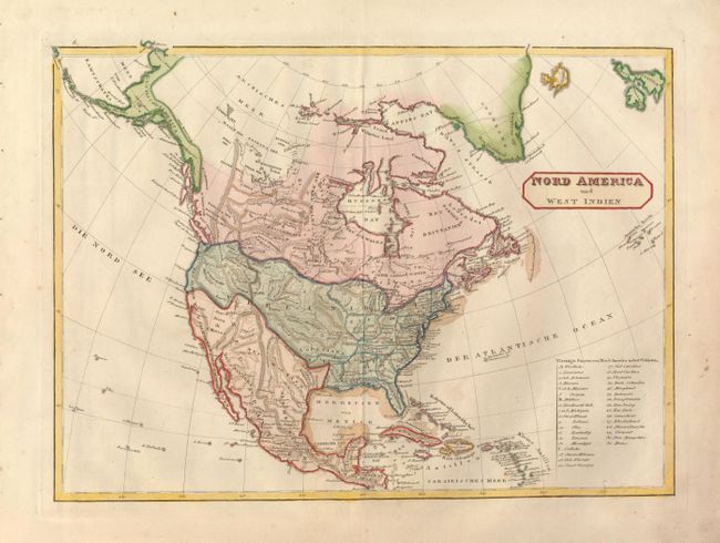
Subject: North America

Period: 1825 (circa)

Publication:

Color: Hand Color

Size:
16 x 12 inches
40.6 x 30.5 cm
Download High Resolution Image
(or just click on image to launch the Zoom viewer)

This German map features some wildly inaccurate boundaries. The International boundary between the United States and Canada undulates in an unfamiliar fashion between Lake Superior and the Pacific Ocean and the boundary between Mexico and the huge Louisiana Territory follows a similar tortuous route east to west. Alaska is Russisches America and is composed of a narrow coastal strip that extends south in rough approximation to what Alaskans today refer to as the "Southeast." In the west, the Great Basin is Siera de S. Marcos with few recognizable place names. A few exceptions are Monterrey, the Gila River and Santa Fe. The map pre-dates the creation of Texas so the area is included in Mexico. Numerous Indian tribes are named throughout. Legend locates all states and countries by letter or number.

References:

Condition: A

Wide margins, dark impression and excellent original color. Some marginal spotting or soiling. Two large script watermarks plus the number "291." Binding stitching holes in left side margin.

Estimate: $150 - $180

Sold for: $100

Closed on 9/1/2010

Archived