Catalog Archive
Auction 133, Lot 711

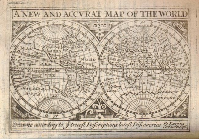
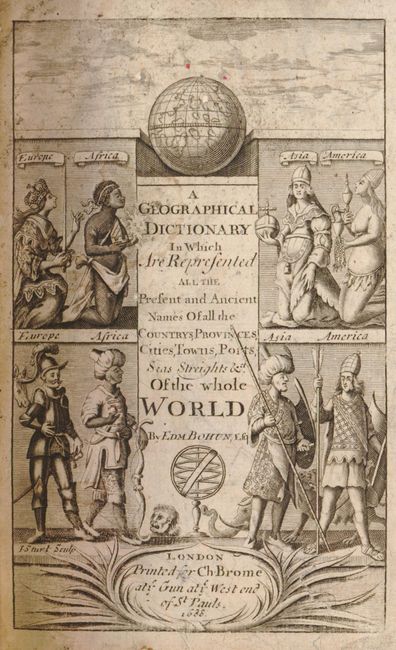
"A Geographical Dictionary Representing the Present and Ancient Names of all the Countries, Provinces, Remarkable Cities, Universities, Ports, Towns, Mountains, Seas, Streights, Fountains, and Rivers of the Whole World", Brome, Charles

Subject: Atlases

Period: 1691 (dated)

Publication:

Color: Black & White

Size:
5 x 7 inches
12.7 x 17.8 cm
Download High Resolution Image
(or just click on image to launch the Zoom viewer)

This complete atlas contains the double hemisphere world map and two title pages. The first title page, dated 1688, is decorated with four panels showing peoples and costumes from around the world with a sphere above. The title on this page is slightly different: "A Geographical Dictionary in Which are Represented all the Present and Ancient Names of all the Countrys, Provinces, Cities, Towns, Ports, Sea Streights & ct. of the Whole World." The second title page is text only, printed in red and black, is dated 1691 and carries the title as given above, which continues "Their Distances, Longitudes, and Latitudes, with a short Historical Account of the same; and their Present State: To which is added an Index of the Ancient and Latin Names". Very necessary for the right understanding of all Modern Histories, and especially of the divers Accounts of the present Transactions of Europe. By Edward Bohun, Esquire." Published by Charles Brome "at the Gun at the West end of St. Pauls." The 1691 title page notes the atlas is "the Second Edition, Corrected and Enlarged, together with several Useful Maps not in the former Edition." The mention of additional maps is confusing because only the world map is present and there is nothing to suggest others were included in this volume. Hardbound in full leather with raised bands, 8vo in full leather, two title pages, map, unpaginated text, table of longitudes and latitudes, and Index, at rear. Although the pages are not numbered the atlas is about 2" thick.

The world map, on casual inspection, appears as the 1646 Pieter van der Keere version that appeared in John Speed's miniature 'Prospect of the World'. However, this map is actually from a new plate that presents identical geography except for a little less coastal hatching. King, in his book 'Miniature Maps' suggests the possibility that the engraver was Sturt, who engraved the frontispiece of this atlas. The large Terra Incognito is shown but simply labeled as the "unknown land" and Western North America is labeled as "Hispanic".

References: KING: p.35 (illus) & 116; SHIRLEY: 368.

Condition: B+

Physical damage to two pages (in WA section) with 1" area missing. First title page with some small worm holes. The map is very good with a little toning around edges. Full leather binding is rubbed and worn, contents with overall age toning but signatures are tight and the pages are sound and supple.

Estimate: $750 - $900

Sold for: $550

Closed on 9/1/2010

Archived