Catalog Archive
Auction 133, Lot 649

"Sumatra", Ramusio, Giovanni Battista

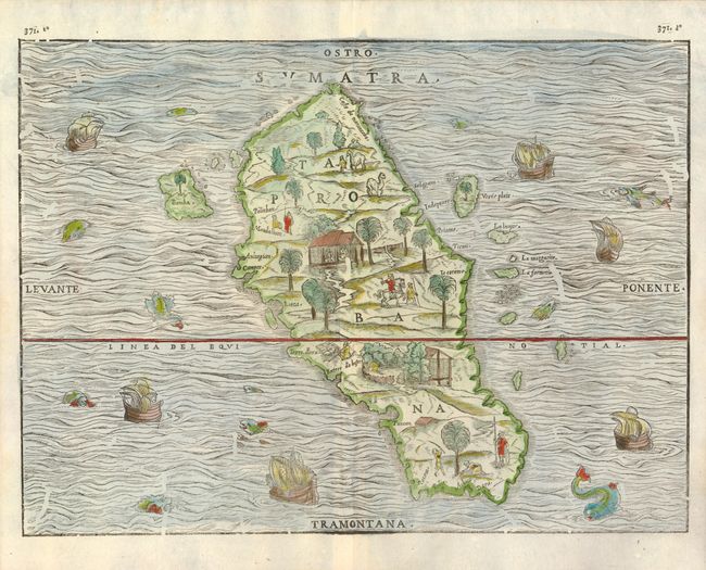
Subject: Sumatra, Indonesia

Period: 1606 (circa)

Publication: Raccolta di Navigationi et Viaggi

Color: Hand Color

Size:
14.5 x 10.6 inches
36.8 x 26.9 cm
Download High Resolution Image
(or just click on image to launch the Zoom viewer)

This fine woodcut map of Sumatra (Taprobana) is the first separate map of an Indonesian island to be based on actual empirical data. Based on the observations of the Parmentier brothers, Frenchmen who ran the Portuguese blockade of the East Indies and landed on the west Sumatran coast. Both brothers died of fever and their crew did not acquire a great deal of wealth, which dissuaded the French from sending further expeditions. Prior to Ramusio's map, Sumatra had been confused with Sri Lanka and maps of the island contained conjectural geography based primarily on Marco Polo. The map is oriented with south at the top and the shape of the island and many of its features are quite accurately portrayed. However, the nearby coastlines of Malaysia and Java are completely missing, although several of the surrounding small islands, such as Bancha (Banca) are shown. Charming scenes in the interior shows vegetation, animals, and native figures at work and play, and there are numerous ships and creatures in the sea. There is evidence of worming on the woodblock.

References: Suarez (SEA) p.157, fig.#77

Condition: A+

Estimate: $600 - $800

Sold for: $650

Closed on 9/1/2010

Archived