Catalog Archive
Auction 133, Lot 636

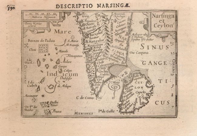
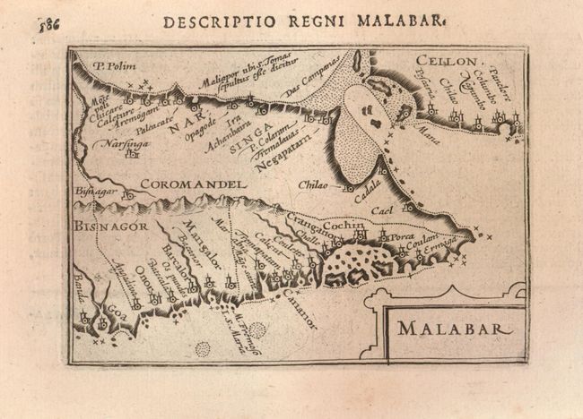
"[Lot of 2] Narsinga et Ceylon [and] Malabar", Bertius/Claesz

Subject: India and Sri Lanka

Period: 1602 (circa)

Publication: Tabularum geographicarum contractarum

Color: Black & White

Size:
4.8 x 3.4 inches
12.2 x 8.6 cm
Download High Resolution Image
(or just click on image to launch the Zoom viewer)

Petrus Kaerius engraved these early miniature maps of southern India and Ceylon. The first map is oriented with north at top and covers the tip of the subcontinent and all of Sri Lanka. Narsinga, referred to as the Kingdom of Bisnaga by the Portuguese, was the Hindu Vijayanagara Empire that controlled southern India. This is the second state with latitude markings in the right border. The second map is oriented with north to the left. It also covers southern India, but only a small part of Sri Lanka. This map focuses on the Malabar coast from Goa to Cape Comorin and the historic port cities that served as centers of the Indian Ocean trade for centuries.

References: King (2nd ed.) pp. 80-82.

Condition: A

Faint foxing in blank margins with remnants of hinges on versos.

Estimate: $200 - $250

Sold for: $150

Closed on 9/1/2010

Archived