Catalog Archive
Auction 133, Lot 520

"Nouvelle Carte de la Hongrie Divisee Selon ses Differents Etats Avec Une Chronologie de ses Ducs…", Chatelain, Henry Abraham

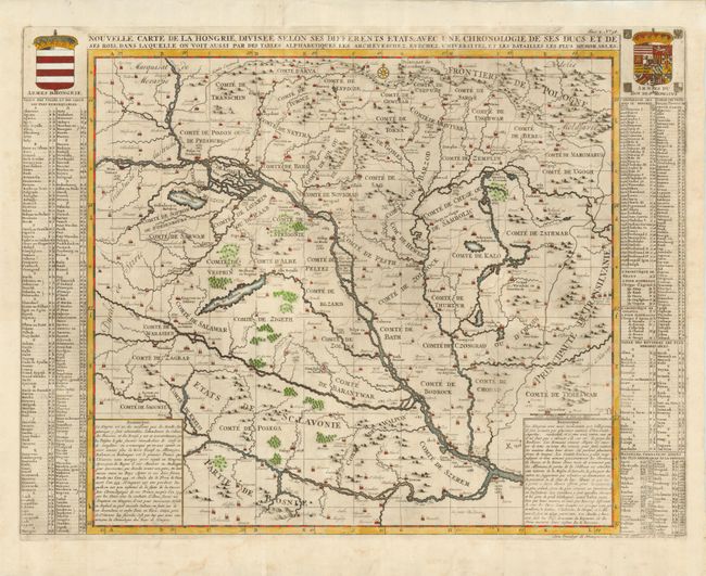
Subject: Southeastern Europe, Hungary

Period: 1719 (published)

Publication:

Color: Hand Color

Size:
24.5 x 18.5 inches
62.2 x 47 cm
Download High Resolution Image
(or just click on image to launch the Zoom viewer)

Darkly and strongly engraved map that focuses on the Danube River, naming the countries and royal regions throughout. The map extends along the Danube from Vienna at upper left to Belgrade at lower right. The numerous towns and villages are indicated with various sized icons suggesting their importance via the number of tiny buildings contained in the icon. Locates Zagreb, Bath, Thurtur, Gutta and many more. Also names many regions/countries including the "Comte" of Bath, Sporon, Bodrock, Sag, Novigrad and many more. Compass rose at top and embellished with the royal coats of arms of Hungary and the Roman Emperor. At the sides are extensive tables listing all towns, cities, and rivers, as well as military battles and sieges. At the map's upper right is the "Frontieres de Pologne."

References:

Condition: B+

Nicely colored with a very dark impression on a thick sheet of hand laid paper with wide, original margins and blank verso. Issued folding, now flattened. Very nice example that has very faint offsetting or toning and a tiny tear in the top margin.

Estimate: $375 - $450

Unsold

Closed on 9/1/2010

Archived