Catalog Archive
Auction 133, Lot 462

"A New and Exact Map of Spain & Portugal Divided into its Kingdoms and Principalities &c.", Moll, Herman

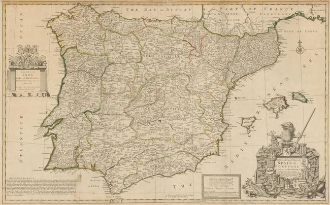
Subject: Spain & Portugal

Period: 1711 (dated)

Publication: The World Described

Color: Hand Color

Size:
38.3 x 23.8 inches
97.3 x 60.5 cm
Download High Resolution Image
(or just click on image to launch the Zoom viewer)

Splendid map of the whole Iberian peninsula and the Balearic islands, with an amusing note berating the publishers of other "inaccurate" maps "put out by Ignorant Pretenders." The map includes a huge amount of information including roads, bridges and the "places where battles &c. have been fought by the English mentioned in history." The huge title cartouche incorporates the coats of arms of the kingdoms and principalities and on the opposite side of the map is a decorative dedication to John Duke of Argilies. Two sheet joined, as issued.

References:

Condition: B+

Original outline color. There are some candle wax stains in the map and a couple marginal tears, else very good. Remnants of brown paper mounting hinges on verso.

Estimate: $700 - $800

Sold for: $500

Closed on 9/1/2010

Archived