Catalog Archive
Auction 133, Lot 455

"Cinquieme Plan de la Ville de Paris", Fer, Nicolas de

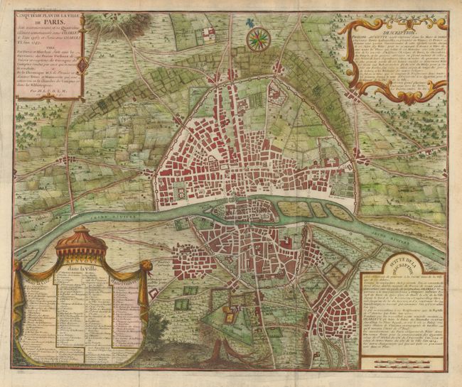
Subject: Paris, France

Period: 1705 (dated)

Publication:

Color: Hand Color

Size:
21 x 17.3 inches
53.3 x 43.9 cm
Download High Resolution Image
(or just click on image to launch the Zoom viewer)

This is the fifth map in a series of eight that illustrates the growth of the city of Paris. This map shows its growth under Charles V and Charles VI between 1367 and 1383. During this period major improvements in the defensive system of Paris were undertaken including the third wall on the north side of the city. There was considerable growth on the north side within this new wall and on the south side, outside the walls. The cartouches at right provide a detailed description of the changes and the cartouche at lower left provides an extensive key to the map. Designed and engraved by A. Coquart.

References:

Condition: B+

issued folded, now flattened. There is an old repair on the fold intersection with a tiny bit of paper loss.

Estimate: $700 - $800

Sold for: $700

Closed on 9/1/2010

Archived