Catalog Archive
Auction 133, Lot 422
"Flandria, Brabantia, et Holanda Nova", Ruscelli, Girolamo
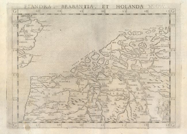
Subject: Low Countries
Period: 1599 (circa)
Publication:
Color: Black & White
Size:
9.8 x 7.2 inches
24.9 x 18.3 cm
Download High Resolution Image
(or just click on image to launch the Zoom viewer)
(or just click on image to launch the Zoom viewer)