Catalog Archive
Auction 133, Lot 391

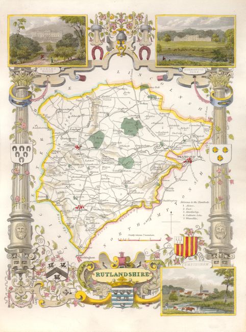
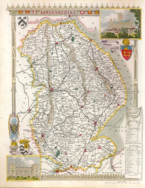
"[Lot of 3 ] Nottinghamshire [and] Rutlandshire [and] Lincolnshire", Moule, Thomas

Subject: England

Period: 1845 (circa)

Publication: Barclays Complete and Universal English Dictionary

Color: Hand Color

Size:
7.5 x 10 inches
19.1 x 25.4 cm
Download High Resolution Image
(or just click on image to launch the Zoom viewer)

Thomas Moule (1784 – 1851) was a writer, bookseller, publisher, topographer and a scholar in heraldry. His varied career led him in 1830 to produce a series of English county map based on his own travel. He wrote that he has “with expensive diligence personally visited every county in England, excepting only Devonshire and Cornwall.” His maps were delicately engraved on steel in a highly decorative style, featured such embellishments as armorial bearings, figures, fancy borders and vignettes of local interest. This amount of ornamentation in mapmaking was unusual for the period as most mapmaker’s were instead creating scientifically accurate, austere works. His series of county maps were originally published in separate sections for each county (1830-32), then subsequently published in a two-volume work: The English Counties Delineated…, (1836). Beginning in 1841, the maps appeared in Barclays Complete and Universal English Dictionary.

This trio of attractive steel engraved maps provides detailed information of their respective counties, cities, towns, roads, canals and parks.

Nottinghamshire, circa 1850. Vignette views of Worksop Manor, Nottingham Castle, and Newstead Abbey. Includes coats of arms, a woman with her dog and a mermaid combing her hair.
Rutlandshire, circa 1845. Vignettes of Burley House, Normanton Park and Empingham. Bordered by strapwork, and columns with vines and coats of arms.
Lincolnshire, circa 1850. With vignette views of Lincoln Cathedral and Grimsthorpe Castle. Decorative border and coats of arms.

References:

Condition: A+

Estimate: $180 - $220

Sold for: $120

Closed on 9/1/2010

Archived