Catalog Archive
Auction 133, Lot 386

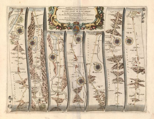
"The Roads from Kendal in Westmer. to Cockermouth and Egremond to the City of Carlisle in Cumberland", Ogilby, John

Subject: England

Period: 1675-98 (published)

Publication: Britannia

Color: Hand Color

Size:
17.5 x 13.3 inches
44.5 x 33.8 cm
Download High Resolution Image
(or just click on image to launch the Zoom viewer)

John Ogilby's 'Britannia' was published between 1675 and 1698. It is a landmark in the mapping of England and Wales. Its unique format constituted the first national road-atlas of any country in Western Europe. It was composed of maps of seventy-three major roads and cross-roads, presented in a continuous strip-form, on a uniform scale of one inch to a mile. Each beautiful map includes wonderful detail of the countryside with each strip containing a large compass rose to indicate changes in direction.

This road winds through the mountainous terrain beginning at Kendal through the towns of Stanlay, Ambleside, Cockermouth, Egremont and ending at Carlisle for a total distance of 39 miles. This map is more detailed than most from this series and uses seven panels rather than the normal six. Each panel has a decorative compass rose to orient the traveler. Title cartouche in a strapwork and garland style with the royal coat of arms.

References:

Condition: A

Near fine example with wide, original margins, dark impression and fine color. Pair of small marginal worm tracks in lower corners infilled from verso.

Estimate: $350 - $400

Sold for: $250

Closed on 9/1/2010

Archived