Catalog Archive
Auction 133, Lot 362

"Nouvelle Carte de l'Ocean Atlantique et Theatre de la Guerre Tant en Europe qu'en Amerique", Denis, Louis

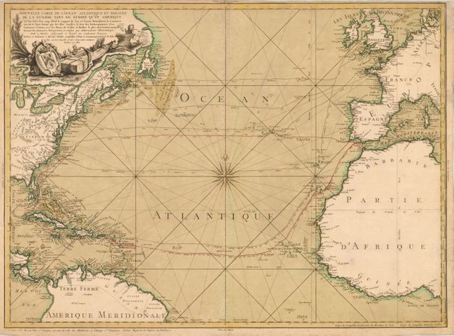
Subject: Atlantic Ocean

Period: 1782 (dated)

Publication:

Color: Hand Color

Size:
28.7 x 21 inches
72.9 x 53.3 cm
Download High Resolution Image
(or just click on image to launch the Zoom viewer)

This handsome chart of the North Atlantic was drawn to illustrate the important trade routes between Europe and North America and the West Indies. It also shows the theater of the America Revolutionary War in which France and Spain joined the Americas against Britain, in part to secure stronger positions in transatlantic trade. The chart is centered on a large compass rose and extends to show a good portion of the landmasses with detail concentrated along the coastlines. In North America the rivers and Great Lakes are included with the locations of several forts. The trade routes are carefully laid out, colored and labeled. The title cartouche has a nautical and military theme with the arms of Jean-Charles-Pierre Lenoir, Lt. General de Police, to whom the map is dedicated. This rare map was separately published by Basset.

References:

Condition: B+

Nice impression and original color with some minor toning and a bit of foxing. A couple marginal tears and the top centerfold have been repaired with tissue on verso. Narrow top margin, as issued.

Estimate: $1,700 - $2,100

Sold for: $1,100

Closed on 9/1/2010

Archived