Catalog Archive
Auction 133, Lot 360

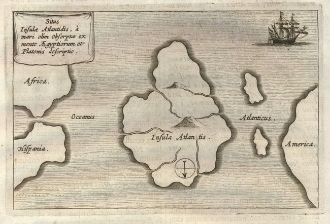
"Situs Insulae Atlantidis, a Mari olim absorptae ex mente Aegyptiorum et Platonis descriptio", Kircher, Athanasius

Subject: Atlantic Ocean - Atlantis

Period: 1678 (circa)

Publication: Mundus Subterraneus

Color: Black & White

Size:
6.3 x 4 inches
16 x 10.2 cm
Download High Resolution Image
(or just click on image to launch the Zoom viewer)

This mythical map of Atlantis is printed with north at the bottom, leaving the coast of America to the right, and Africa and Spain on the left. The Island of Atlantis (Insula Atlantis) is a huge land mass which occupies a majority of the Atlantic Ocean. Two mountains and six rivers are depicted within the island, otherwise the interior is blank. The map is embellished with a fully ruled sea, a two masted sailing ship at upper right, a curtain-style cartouche and a simple compass rose. It is on a full sheet (9.4" 15.7") with Latin text above and below the map, and fully on the verso. From Kircher's masterpiece, Mundus subterraneus (The Underground World) which was the first serious effort to describe the physical makeup of the earth, proposing theories (sometimes fantastic) in the areas of physics, geography, geology, and chemistry.

References:

Condition: A

The map image is very good. The full text sheet has a water stain along top edge, well away from the map image (B+).

Estimate: $300 - $350

Sold for: $350

Closed on 9/1/2010

Archived