Catalog Archive
Auction 133, Lot 311

"Guayane, Terre Ferme, Isles Antilles, et Nlle. Espagne", Brion de la Tour/Desnos

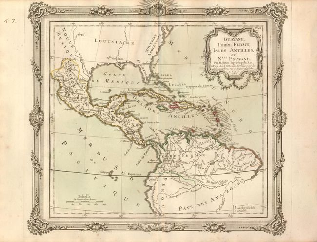
Subject: Gulf of Mexico, Caribbean & Northern South America

Period: 1766 (dated)

Publication: Atlas General, civil, ecclesiastique et militaire

Color: Hand Color

Size:
12 x 10.8 inches
30.5 x 27.4 cm
Download High Resolution Image
(or just click on image to launch the Zoom viewer)

This unusual map focuses on Mexico, Central America, northern South America and all of the islands of the West Indies. There is no topographical detail shown in North America or below the Amazon River. The coloring illustrates the various colonial possessions and symbols locate missions throughout the region. The map is embellished with a rococo-style cartouche and highly decorative borders that were printed from a separate copperplate.

References:

Condition: B+

Original color with a few insignificants spots. Remnants of mounting hinges on verso.

Estimate: $130 - $180

Unsold

Closed on 9/1/2010

Archived