Catalog Archive
Auction 133, Lot 30

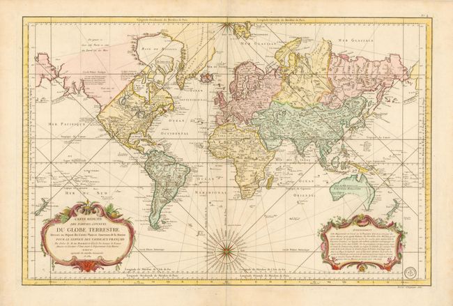
"Carte Reduite des Parties Connues du Globe Terrestre, Dressee au Depost des Cartes Plans et Journaux de la Marine pour le Service des Vaisseaux Francais…", Bellin, Jacques Nicolas

Subject: World

Period: 1784 (dated)

Publication:

Color: Hand Color

Size:
32.3 x 21.3 inches
82 x 54.1 cm
Download High Resolution Image
(or just click on image to launch the Zoom viewer)

This is an updated version of Bellin's large-scale chart of the world on Mercator's projection, which was first published in 1755. The northwest coast of North America, and the opposite coast of Asia, have been revised using information from Cook's voyages and Alaska appears in a rudimentary shape. Gone is the spurious river/lake network that provided a possible Northwest Passage. But there are notations concerning the supposed discoveries of Admiral Fuente and the continued search for the passage by the British. Several new islands appear in the oceans, including the Iles Sandwich (Hawaii) where Cook met his demise. Australia and New Zealand reflect the discoveries of Capt. Cook, but Tasmania is still attached to Australia. Issued by the Depot de la Marine with their seal at bottom right and Prix. Cinquante Sols below neatline. Dated 1784, but published post French Revolution as the title has been changed from du Roy to Francais.

References:

Condition: A+

A very fine example.

Estimate: $900 - $1,100

Sold for: $850

Closed on 9/1/2010

Archived