Catalog Archive
Auction 133, Lot 285

"Vermont from Actual Survey", Doolittle, Amos
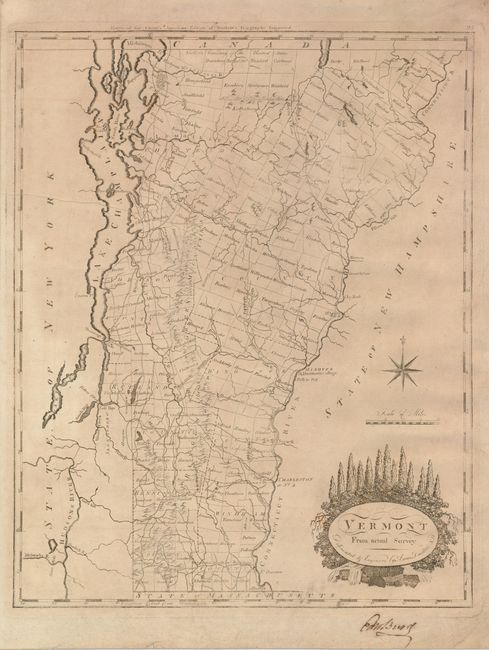
Subject: Vermont

Period: 1800 (circa)

Publication: Carey's General Atlas

Color: Black & White

Size:
11.8 x 15 inches
30 x 38.1 cm
Download High Resolution Image
(or just click on image to launch the Zoom viewer)

This early map of Vermont is the second edition as evidenced "Engraved for Carey's American Edition of Guthrie's Geography Improved" above the neatline and the number 25 at upper right. It is divided into seven counties with townships shown and named. The major towns, Dartmouth College and a fairly extensive road network is delineated. Amos Doolittle was a New Hampshire cartographer and engraver, who produced many of the best early maps of New England. This map of Vermont is a fine example of his work. However, this rare edition is backed with contemporary linen and does not appear to have been published in atlas form.

References: Wheat & Brun #195.

Condition: B+

Overall even toning and a printer's crease in the map. There is a previous owner's signature in brown ink in the bottom margin.

Estimate: $500 - $700

Unsold

Closed on 9/1/2010

Archived